
admelioraii
Ad Meliora
Passionate about travel, culture and languages.Link to Navigation PageFind me on MediumAd Meliora en Español
73 posts
Don't wanna be here? Send us removal request.
Last Seen Blogs

mylettes-blog
Mylëttë Biersack

wildes-leben
vielleicht wird alles vielleichter

roybbeautiful2
A Place For Beauty

jadejayded
jade jaded

hauntinggroundfan
Haunting Ground fanblog
Text
Yalova, the Radiant Garden Of Istanbul
Our trip to the kingdom above
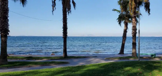
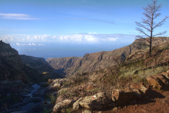
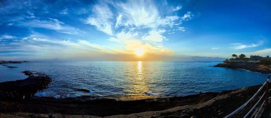
A view of the Marmara sea, with a view of Istanbul on the other side of the waters. Image by author.’
As we arrived in the charming little city of Yalova, we rented a tiny rooftop apartment on the last floor, in the midst of the centre. It was probably one of the highest buildings in town, and the reason we had such a memorable view of the entire city, and beyond.
And it was the “beyond” that was the extra bonus.
To the north of our little nest, we could see the shores of the Marmara Sea with the bustling city of Istanbul on the horizon. During the day it appeared as a faraway mirage and a reminder that busy cities still exist. And at night a glittering shiny pearl band of sparkling lights reflected in the dark waters.
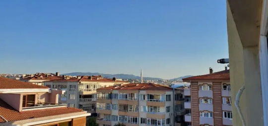
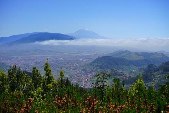
View of the mountains in the south from the apartment we stayed at. Image by author.
To the south, the panorama was not less satisfying, as the place looked at the forest-covered hills that slowly grew into enormous emerald green mountains, and somewhere far beyond the eye could see, we were sure mount Uludağ was watching us, with its snow-covered peaks.
A magnificent view, a heavenly scenery, in the kingdom above!
A Charming Little City
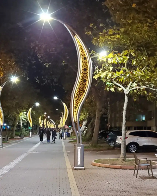
The unique street lights of Yalova. Image by author.
Incomparable to its huge neighbour the metropolitan city of Istanbul, whose Richmond of life with its busy streets and swelling population gives the city a much faster heartbeat.
A city that bears witness to many centuries of great history, that saw the rise and fall of Empires and civilisations whose traditions have shaped the city into what it is today. Unequal to its southwestern neighbour of Bursa, another busy, influential, rich historical and eminent city.

Pictures from the yalova termal kaplıcaları hot springs, Yalova. On the top is a picture of a fountain with drinking water from the springs, and on the bottom is where the spring water leaves the mountain. One of the many hot springs in the area. Image by author.
A city housing the great mount Uludağ, ancient Mysian Olympus, towering over it providing protection and as a source of a long line of hot springs.
These thermal baths’ used for therapeutic purposes ever since the time of the Romans and even before, whose healing effects have shaped the region’s history. In sharp contrast to these two bustling significant cities, the little laid-back town of Yalova is much more relaxed and quiet, even so, it too has both its own treasures and story.
Garden of Istanbul

The lush green streets of Yalova. Image by author.
Located not far from Bursa and the majestic snow-covered mount Uludağ, Yalova also shares some of the characteristics of the region, like its extremely fertile earth.
As a result, throughout time the little city developed into a gardening/market town. Its immense greenery and its close proximity to Istanbul made the town earn its nickname: the garden of Istanbul.
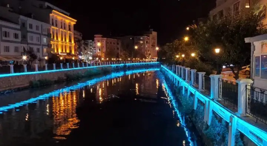
The beautifully lit canal at night. Image by author.
Everywhere in the city’s streets and public parks flowers and blossoms are plentiful, and in contrast to many other places Yalova’s flowers have a scent and give off a heavenly fragrance.
Once ruled by the Hittites, the town’s history dates back five thousand years. Later dominated by the Phrygians and subsequently conquered by the Romans, the little peaceful town has seen a tumultuous past.
In spite of its earlier years of confusion and unrest, it slowly evolved to become a tranquil garden of Eden.
A Shimmering Sea of History

The shimmering Marmara sea. Image by author.
In the 9th century the little settlement by the Marmara Sea, connecting the Black Sea with the Mediterranean, became an important site for transmitting news from the frontier with the Abbasid’s Caliphate and also the reason why it housed an imperial hostel for travellers.
Pylae, as the region was nominated long ago, produced cattle, horses, sheep and other animals as well as fruits and vegetables that were later gathered and shipped to Constantinople, modern-day Istanbul, to be sold.
Pylae means: “Gates of Asia”, and the region most certainly got its name from its strategic location on the ancient main military roads leading to Nicaea and across Asia Minor, to the eastern frontier. The city of Pylae disappeared in the late Middle Ages but is thought to be located somewhat to the southwest of modern-day Yalova.
After Christian Constantinople became Muslim, Yalova was incorporated into the Ottoman Empire and was known successively as “Yalakabad” and “Yalıova”. The name “Yalıova” is assumed to be a contraction of Yalı, meaning; house at the hill, and -ova, meaning; plain in Turkish.
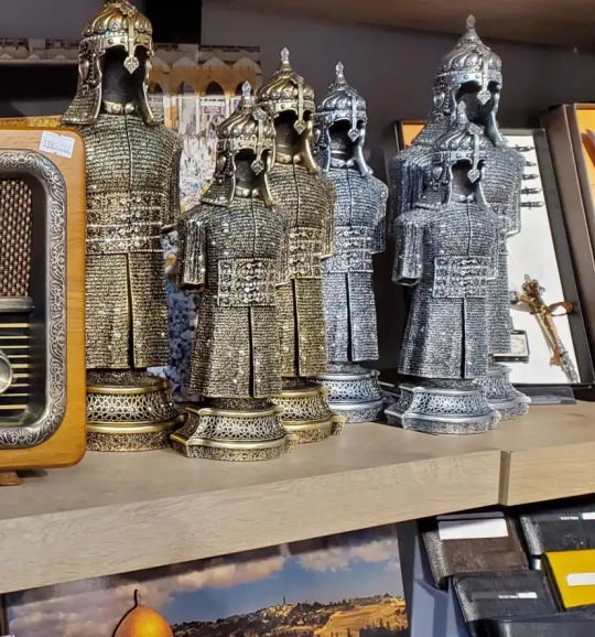
A replica of the armour of the Islamic leader Saladin al-Ayyub in a souvenir shop. Image by author.
Thanks to the city’s proximity to snowy Mount Uludağ, which is the source of a long line of hot springs in the area, Yalova included, and as a result, has a generous amount of thermal baths.
Thermal derives from the Greek; thermal, meaning warm. Each hot spring has its own distinct water temperature ranging from 55º- 80º, as well as its special water composition that differs from place to place and each cures a specific variety of diseases.
Today Yalova, the pearl of Marmara, shines brightly in a region where tough topography, fecund earth, a mild climate, and a spectacular sea view, are all surrounded by lush green countryside enabling everyone to re-establish contact with nature.
Nothing can surpass a walk along the coastal road or “corniche” where large families fill up the walk, you can’t help but feel a part of them.
Today’s Modern City

The Merkez mosque in Yalova. Image by author.
Besides the sea view is spectacular, and as strange as it may sound, every day this same scenery appears different depending on the time of the day, the weather and the light, and maybe even your own mood. Every day the same place has a new panorama that awaits even more beauty than the one yesterday.
Just a simple walk through the heart of the city is unforgettable and charmingly decorated; it resembles a fairytale. Its cobbled streets and narrow plazas are a reminder of past times, times of history and prosperity, in the powerful Ottoman Caliphate.
It is first when passing by the Merkez mosque in downtown a grim reminder of a modern catastrophe comes to mind, memories of the town’s vulnerability and the day when disaster struck. On 17 August 1999, a forceful earthquake struck the region of Marmara, so powerful that it was as if the earth came alive from the fierce shaking.
The sky turned red, and a sword of light flew out of the Sea as a wave as tall as a ship thundered towards land. A great crack opened along the waterfront and people raced inland. The event was followed by a blinding storm of dust from the collapsing buildings that rose over the town towards the shore.
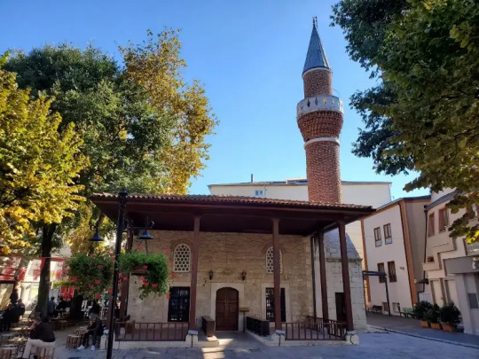
The Merkez mosque in Yalova. Image by author.
It was first when the dust settled the result of the catastrophe became clear. The mosque in the centre of the city was one of the numerous buildings that had collapsed. On the little that remained of the foundations of the old mosque stands today a small school teaching the holy Quran.
A new mosque has been constructed beside the place where the old mosque once stood, with financial support from Japan, which houses a twin mosque that is an exact copy of this mosque.
After each adventurous day, we would return to our rooftop nest, high above, where the building punctured the sky, seeking a night’s rest.
Every morning as the sun rose, we opened our eyes and realised that we were meticulously observed by a grey feather creature, the king of the crows, whose watchful eye constantly reminded us that we were part of his kingdom now.
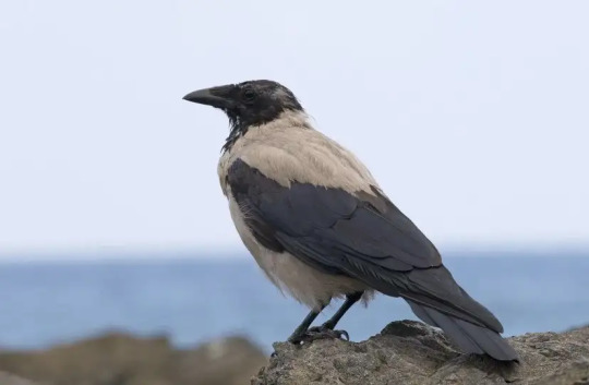
Unfortunately, I did not take a picture of the crow that stood in front of our window each morning. But this is a Turkish Hooded Crow that looks just like him. Image source: WikimediaCommons.
A kingdom whose population consisted of a mix of; seagulls, ravens, doves, a mix of smaller birds, crows and us. To keep order in the kingdom he was probably one of the most hardworking creatures in the entire city, nothing escaped his vigilant sight.
He was aware of, observed and knew everything and everyone in his domain. But it somehow felt assuring to form part of this community, protected by his wings and rule.
For now, we had a magnificent view up here as we safely belonged to the kingdom above.
8 notes
·
View notes
Text
Baiae; where the privileged of the Roman upper class indulged in shady affairs
The Ancient Roman Thermal Resort That Got Punished by Its Blessings
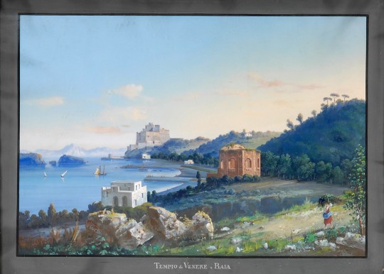
Tempio di Venere a Baia (19th century). Image source: WikimediaCommons.
During Roman times the upper classes had the extravagant habit of searching for elegant and expensive places outside the busy Roman capital, where they purchased fancy villas and luxurious mansions in which they spent their holidays and free time. They fancied spending some quality time far from Rome’s busy, noisy, and dusty metropolis, closer to the countryside in a place for relaxation and pleasure.
Wealthy Romans settled for Capri, Pompeii and Herculaneum. But there was one place that was far more exclusive and classy than the rest of the resorts, it was Baia or Baiae reckoned far superior and fashionable and the visitors that frequented the stylish and trendy thermal resort together with its residents in possession of lavish villas on its beaches and shores were of far higher status. It was the most privileged of the privileged of the Roman upper class, its “Elite”, and the affairs they were indulged in would prove to be far more illicit, shady and sinister than anywhere in the Roman Empire.
In Rome, nothing escaped the watchful eye of the powerful senate, which held an iron grip on Rome and its political leaders. But in Baiae, things were different, it was a place where everything was possible, here things happened through corruption, manipulation and bribes.
Baiae’s Potentials
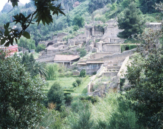
Roman ruins in Baiae, Italy. Image source: flickr.
From the beginning, Baiae wasn’t but an ancient, small, and insignificant Roman town on the northwest shore of the Gulf of Naples. But it was its temperate climate and famous mineral springs that first attracted the high Roman nobles to its shores.
With time it turned into a highly fashionable and popular holiday resort for the Roman Elite. Its caldera peppered coast and the proximity to Naples worked like an on Rome’s ultra-wealthy who took weekend trips here to party.
They were fascinated by Baiae’s thermal heated spas and mosaic-covered pools which created an amazing atmosphere where they could indulge their wildest desires. Here is where they came to carry out illicit affairs, more than 2000 years ago.
Baiae was located directly above a collection of natural volcanic vents which were famously acknowledged for their healing medicinal hot springs. The abundance of these hot springs soon created a grand collection of thermal baths as constructing these spas was easy thanks to the already existing natural springs. The public and private baths of Baiae were filled with naturally warm mineral water directed to the pools from the underground hot springs thanks to the Roman engineers who were able to construct a complex system of chambers that channelled underground heat into facilities that acted as saunas.
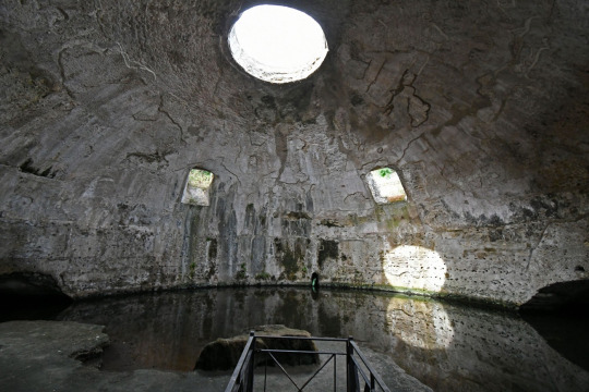
Temple of Mercury, Baiae. Image source: WikimediaCommons.
In addition to their recreational function, the baths were used in Roman medicine, to treat various illnesses, and physicians would attend to their patients at the springs. Baiae was supplied with fresh drinking water from a branch of the Aqua Augusta aqueduct; a cross-section of which can be seen nearby. The water was led via pipelines to an enormous cistern called “Piscina Mirabilis”, this gigantic freshwater cistern provided the whole city of ultra-rich upper-class citizens with fresh water.
Historical Figures in Baiae
There are many tales of intrigue surrounding Baiae, one resident is said to have constructed a Nymphaeum*, surrounded by marble statues and a private grotto dedicated exclusively to earthly pleasures. The guests would gather around the pools not only to bathe but also to have their dinner served as it came floating on enormous dishes down the water in the pools.
*The Nymphaeum served as a sanctuary, a recevoir and a chamber where weddings were held.
Sex scandals were everyday life, and old men came here to become young. Julius Caesar is said to have owned a magnificent mansion in the area, and after he was murdered, Cleopatra is said to have escaped in a boat from Baiae’s shores. Rulers such as Nero and Cicero had their pleasure palaces here and Haridian is said to have died on his property in this city in 138 AD.

The Hemicycle Nymphaeum Theatre, Archaeological park of Baiae. Image source: flickr.
Another dark story is the one when Julia Agrippina plotted her husband’s murder, so her son Nero could become Emperor, on these grounds. She poisoned Claudius with deadly mushrooms, but when he somehow survived the attempt Agrippina got her physician to administer a portion of poisonous wild gourd, which finally did the trick.
Baiae was known to be a prominent high-class resort for centuries, it catered the whims among the Roman Elite, it was, therefore, to expect its notorious reputation for its many hedonistic offerings together with widespread rumours of corruption and scandals. The reason the offerings were frequent was due to the fact that the city rested on natural springs, places that were prone to become offering sites in antiquity.
Baiae’s Connection to the Underworld
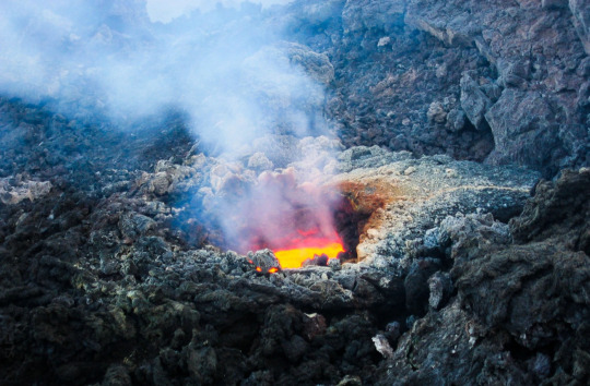
Sulphurous gas in a volcanic entrance to the underworld. Image source: Pxhere.
The calderas were revered by the Ancient Greeks and Romans as entrances to the underworld and thus had magical powers. But there is also a downside to this. Being close to the underworld means you are close to the gods, they will easily hear your prayers but somewhere on the “Phlegraean Fields” or flaming fields there was an opening guiding you to a long and complex underground tunnel network, it would lead you to the Great Antrum deep down in the ground. The Antrum was the portal to the cave leading to the underworld, through its opening flowed rivers of fire, the fabled rivers of Hades: The Styx and the Phlegethon “rivers of fire”, that boiled the souls of the departed.
Even among many mysteries of the ancient world, the great Antrum on the bay of Naples surely remains among the most intriguing. But the circumstances around the resort also encouraged technological advancements such as the local invention of waterproof cement. A cement that consisted of a mixture of volcanic rock and limestone, it prompted the construction of private fish ponds and lavish bathhouses. Most opulent villas had their own fish farm for their private consumption, but as the seawater in the pool quickly evaporated on hot days, it would become saltier and endanger the fish living in it.
The solution they came up with was to supply the ponds with fresh water, during hot summer days, to reduce the saltiness of the pond and prevent the fish from dying. Oysters were hung by the sea in nets, bound together by a rope, just as it is done today, which makes it easy to get to the oysters.
The area known to the Romans as “Phlegraean Fields” is the region containing the calderas and underground tunnel system that form part of a volcano, the twin of mount Vesuvius that destroyed Pompeii and Herculaneum. It once possessed a crater that measured 13 km (eight miles) across, but most of it is underwater now. The flaming fields contain a total of 24 volcanoes which together with the calderas defined the landscape, ironically it was a fitting name.
Baiae’s Downfall
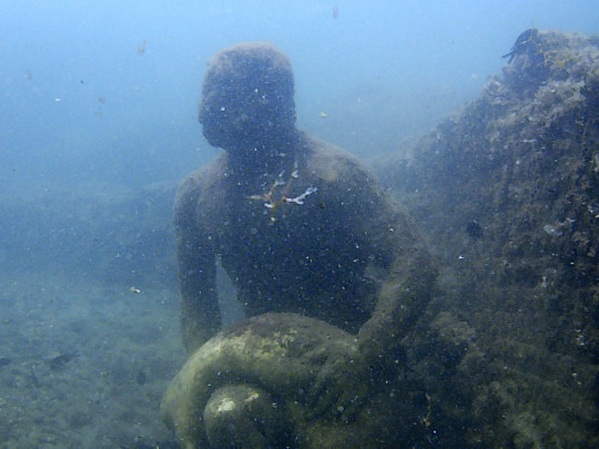
Remains of the Underwater Archaeological Park of Baiae. Image source: WikimediaCommons.
Given Baiae’s sinful reputation it was perhaps paradoxical that the abundant volcanic activity which was the reason for its rise also became its downfall. Over several centuries, bradyseism, the repeated and gradual fall and rise of the Earth’s surface, caused both by hydrothermal and seismic activity as a result much of the city sank into its watery grave, where it sits today. After having seen an aerial photo, taken in the 1940s, rumours started to spread about parts of a hillside with edifices, which had disappeared into the sea.
Twenty years later submarines scanning the area found the lost city, lost since Roman times. Underground pressure had caused the land surrounding Baiae to continuously rise and fall pushing the ancient city’s ruins upwards to the surface only to once again swallow them back into the sea, exactly like a kind of geological purgatory!
It was because of the undulation of the earth, the ruins still lie in relatively shallow waters. But not everything was swallowed by the sea, parts of the city partly escaped the punishment, and a portion of the old resort is still accessible on land; it consists of a barren rubble-strewn plateau. As a consolation, many of the sunken sculptures were actually replicas of the originals that can still be found up on the hill by Baiae Castle.
Fire burst from the rocks in places and clouds of sulphurous gas snakes out of vents leading up from the deep underground. However, the modern Baiae is but a shadow of what it once was, the part remaining on land is surrounded by a hot, smelly sulphurous gas and the part swallowed by the sea is perpetually punished in purgatory. The same forces that once made Baiae so attractive in the first place were to become the ones that destroyed it.
#history#writers on tumblr#writblr#writers#original content#travel#italy#roman#ancient rome#nero#julius caesar#cicero#julia agrippina#baiae#ancient history#resort
4 notes
·
View notes
Text
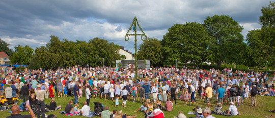
Everything You Need to Know About the Swedish Midsummer
Ancient traditions clouded in mystery and love

Midsummer; a festival of flowers and love.
Midsummer is the longest day of the year, it has long been associated with love, eroticism and magic. In ancient times it was the climax of the year, a time you must be alert, and profit from. This year, Midsummersday falls on the 25th of June.
Anyone who wanted to live a healthy, happy and wealthy life, surrounded by love, had to be prepared and follow the rituals and magic rules, to ensure a prosperous and enriched year!
A mix of traditions
The dance around the maypole is the result of an age-long entanglement of traditions.
Midsummer has been celebrated throughout the European continent in numerous places and across countless timelines. But nowadays it is mostly celebrated in Scandinavia, especially in Sweden and Finland.
The actual beginnings of this tradition in Sweden are engulfed in mystery and confusion. Only small insinuations are mentioned in Medieval sources, and that mostly related to beer drinking rituals and sacrifice during the times of the Vikings. The tradition of the Maypole was undoubtedly brought to Sweden from Germany, sometime during the Middle Ages, when German migration to Sweden was common.
Paintings from the 1600’s century exist, as historical proof, showing Maypoles decorated with leaves and flowers, even though the celebrations took place in May in Germany and by midsummer in Sweden.
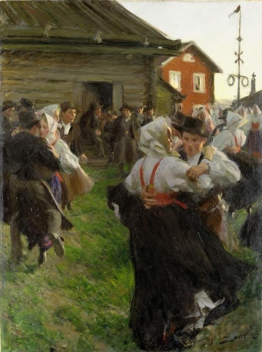
Painting of the midsummer dance, with a maypole in the background, by Anders Zorn.
The reason for this delay was probably the colder climate in Sweden, thus summer arrives later, but by late June leaves and flowers bloom.
Contradictory options as to the source of the name Maypole exist; The first one assures that it got its name from the first of May celebrations in Germany and the rest of the European continent. Others insist the pole got its name from Maja, meaning “decorate with leaves”.
Ancient Swedish folk tradition believed the midsummer night was the most magical night of the year. When nature flowed with powers, and the borders between our world and the world of the magic spiritual world were thin, so thin that the two worlds often got mixed, inside each other, fused together in a moment when everything was possible.
Throughout Europe the 24th of June was and is widely celebrated as John the Baptist's birth anniversary, this religious tradition was also regarded in Sweden where as elsewhere in the continent, fires were lit as a celebration.
The traditions entanglement
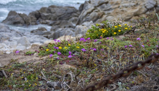
Wildflowers.
But traditions are tricky, they change constantly, which makes it difficult to source their origin, and why they change or sometimes disappear altogether.
The Swedish Midsummer is such a fusion of older and newer traditions, a long, long story whose beginnings are clouded, and covered in mystery. Exactly how it all started is uncertain, even though according to many, the traditional dancing around the Maypole is all that remains of an ancient fertility feast in the honor of the summer solstice.
Even though its ancient roots are long lost in history, the possibility exists that it started out as a festival that implicated the summer solstice most probably fertility was also involved in the celebrations. From there it likely got entangled in Viking traditions, old folk beliefs together with incorporated foreign traditions (German Maypole) and lastly newer religious celebrations.
Their confusing entanglement and complicated fusion make it almost impossible to clearly define from where it first originated.
Many stories of fantastic occurrences are said to have happened during the midsummer eve. Medical herbs collected during that night were believed to be especially powerful and have strong healing powers.
The dew during midsummer was another desirable element, it was thought that the one walking barefoot in that dew would remain healthy the rest of the year. In some places, people even purposely visited midsummer springs and were convinced that when drinking its water that night they were guaranteed to stay healthy for the rest of the year.
It went as far as some people believing that magic treasures could come out of the earth, the one who could remain silent would become rich, and if the silence was broken the treasure would disappear, forever.
Wildflowers under the pillow
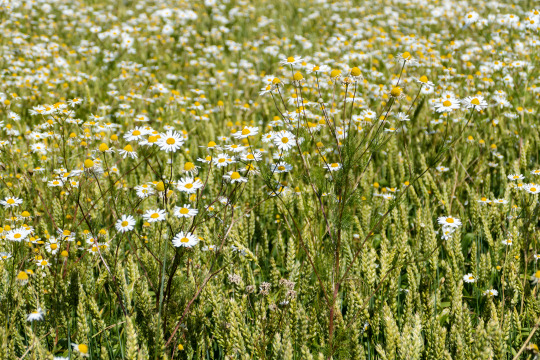
A field of daisies.
As midsummer was considered an important festival for love, it was critical to get to know the identity of your future lover. Love predictions were not only fun games played at midsummer festivals, they were taken seriously.
One kind of magic love prediction still living on until today is the midsummer “wildflowers prediction”. A person picks seven different kinds of wildflowers, and before going to bed they place them under the pillow. During their sleep, they would dream about the person they were going to marry or their future love.
The flowers had to be picked in complete silence, if the silence were broken so was the magic. It had to be seven flowers, each one different from the others. The number seven was important as it was an uneven number, uneven numbers were considered magic. In contrast to even numbers that were harmonious and normal.
The legend
One old legend tells the story of three girls that stayed awake during midsummer eve, beside a crossroad. The first girl heard a noise of a chain, the second girl heard violin music and the third girl heard church bells.
The first girl got married to a blacksmith, whilst the second girl married a musician but the third girl died before the end of the year. The church bells she had heard were from her own funeral.
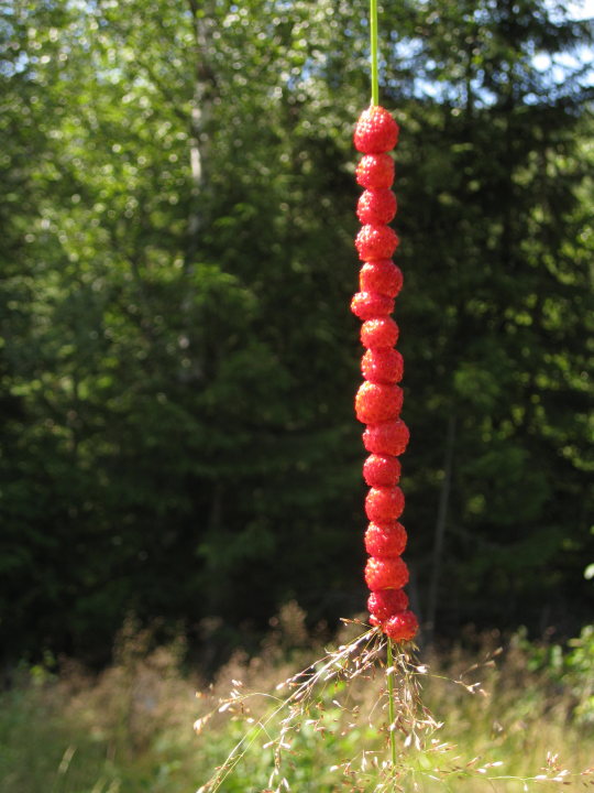
Smultron; the Swedish wild strawberries, as small as peas, usually put on straw when collecting. This is another example of an old Swedish summer tradition.
Final comments
If you are brave and curious enough to experience your own midsummer night dream, you can try it out. Just make sure to follow all the rituals and mystical rules.
Pick seven different wildflowers on midsummer eve, the shortest night of the year. Put them under your pillow, without telling anyone, silence is essential, then dream, sweet, light, hopeful dreams about the one you love or your future partner.
It might make you lucky in love and the dream might come true!
#writers on tumblr#writblr#writers#original content#history#travel#sweden#scandinavia#finland#germany#midsummer#midsommarstang#midsommar#maypole#legends#myths
2 notes
·
View notes
Text
A Romantic Dinner in a “Display Window”
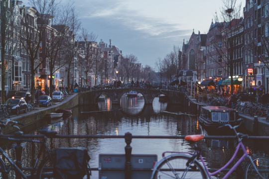
Amsterdam by night.
For context to this story, I grew up learning to respect others in every possible aspect, trying to understand cultural and individual differences as well as being friendly without invading others' personal space.
I can still clearly remember my first visit to the Netherlands as if it was yesterday. It was at the end of spring, I arrived tired from the journey and slept through the afternoon. When I woke up a warm spring breeze with the smell of lilac and hyacinths entered through the half-opened window. After nightfall, I felt like having a walk, as I stayed in Amsterdam it would have to be a city walk.
I started to walk around the already dark city streets when I suddenly saw a building in front of me, the apartment at ground level had an enormous big window facing the main street.
By the window was a table where a couple was having a cosy dinner, the lights were on inside and you could see, everything from what they were eating, and what they doing to how the house looked inside, you could practically see through the apartment to the other side, where they had a private garden.
To my astonishment, they were having a romantic dinner in a display window! The only thing still missing would be to hear their conversation. I felt so embarrassed, I wanted to go and cover the window, to protect them from public view and give them some well-needed privacy.
I was convinced they had just moved in and had yet to put up their curtains.
After several weeks and multiple city walks by night, I discovered it was a common habit in the Netherlands; not to have curtains or seek privacy. I also discovered that they were awfully rude, according to my point of view.
Waiters at restaurants or cafes ask you: “what do you want?” Instead of: “Can I help you?”, or “What do you like?”.
A famous Dutch idiom used in place of saying “you are imagining things” is “It zit tussen je oren” (meaning; the problem is sitting between your ears), a rather rude way of expressing it, if I may say. But the Dutch themselves call it “straightforwardness” and they are very proud of it!

A canal in Amsterdam.
To better understand the Dutch mentality and what lies behind it, I asked a Dutch friend specializing in international relations, to explain it to me. Dutch never sugarcoat things and do often come across as inconsiderate.
What in many other cultures is “normal” like; You don’t talk loudly on the train, or play loud music in your apartment because it might offend others, Dutch people experience differently. They argue that they have the right to say what they want to whom they want, if others don’t like it, it is their own fault for getting offended.
Truthfulness goes before empathy, in the Dutch mentality. Dutch do not pretend, and they are especially direct in Amsterdam. It is all connected to the historical prevalence of Calvinism in the Netherlands.
After the start of the reformation in the 16th century, Calvinism spread to France, Scotland and the Netherlands, but has only deep roots in the latter, where it coincided with the fight for independence from Catholic Spain, which ruled over the Netherlands from 1556 to 1581. After regaining independence from Spain the country was reunited and became Calvinistic.
Ever since, Calvinism has dictated the country’s moral points of view, like salvage through introspection, total honesty, soberness and rejection of pleasure.
Even though the religion has partly faded away, this straightforwardness is still so deeply rooted in Dutch society that they even have a word for it “Bespreekbaarheid” (meaning: speakability). It means that we have to be able to speak about everything, openly.
In fact, directness and the idea of transparency that goes with it is a highly desirable trait to the Dutch. That’s why many houses have big windows, allowing visitors to look inside, because as they see it: they have nothing to hide!
Their concept of privacy is totally different from neighbouring countries.
A long time has passed since I first visited the Netherlands but I have returned many times. Even though I now understand the reasons behind the Dutch “transparency” and everything that comes with it, I will never forget that first night and the couple that had dinner in a display window.
#writers on tumblr#writblr#writers#original content#travel#the netherlands#amsterdam#dinner#europe travel#traveling
0 notes
Text
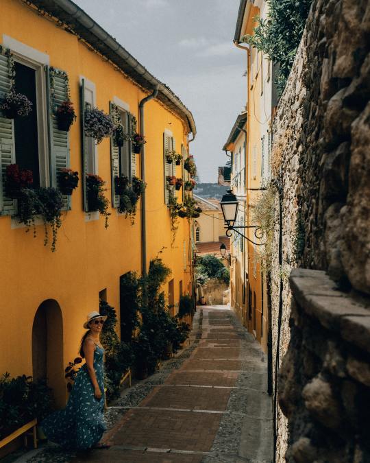
Menton, the Hidden Gem of Southern France
The city with the golden gardens; the lost Eden

The golden city of Menton, France.
Follow the divinely scented breeze, it will lead you to a remote corner, on the edge of two worlds. What you will see next will take you by surprise.
A pastel-coloured historical city, surrounded by a bright yellow paradise garden. It is from here that the fragrance originates, and when you find this golden garden you realise you have found the secret.
While tourists from everywhere flock around the famous French Riviera, anxious to see the glamorous and glittery cities of Nice and Cannes, they are just footsteps away from an undiscovered gem. Passing by its vicinity they remain oblivious to the hidden charms of Menton, one of the small forgotten villages dotting the Azur blue Mediterranean.
Menton is special in all aspects; it is a tiny bit too small to be called a city, but somehow also too big to be a village. Simply put, it is a city under a village coat!
Caught between two worlds
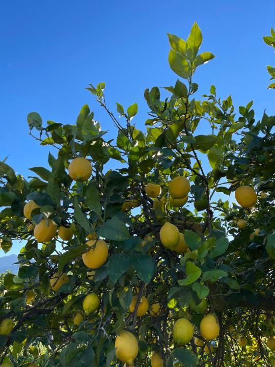
Lemon trees.
Menton is a lovely small town in the southeastern most corner of France, that has the best of everything; a warm climate year-round, beautiful gardens, excellent French and Italian cuisines, sandy beaches at the foot of the aqua blue Mediterranean Sea, and a colourful historic old town. The old town offers an uphill climb, something in between a walk and a hike.
It forms the borders between Provence in France and Genoa in Italy. The city was Italian until the disputed French plebiscite of 1860 when it became French. Every location has its special qualities, individual traits, and unique attributes that make it suitable for distinctive purposes. The truth is that Menton lies on the edge of two completely different worlds; exactly on the borders between France and Italy, we can sincerely say that it has got the best of two worlds!
It is blessed with the perfect environmental circumstances needed for optimal lemon cultivation. According to locals, it all began when Adam and Eve were thrown out of paradise, and had brought with them a magnificent “golden” fruit, the lemon.
As they feared retribution and wanted to get rid of the fruit, they searched everywhere for a suitable location worthy of planting their lemon. Finally, they chose Menton and called it “the lost Eden”.
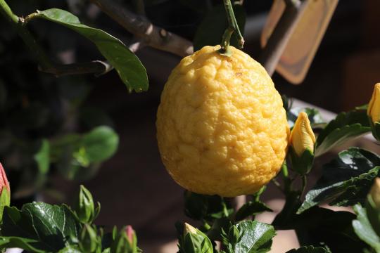
The special Menton lemon.
A more modern idea is that Menton’s lemon rise started with the fruit’s arrival from Spain in the 15th century. It quickly adapted to the beneficial and suitable temperate microclimate created by the unique combination of a protective mountain range and the close proximity to the sea. It started as small, intimate family cultivations only to later grow into a large-scale commerce.
Menton has the warmest climate in France, a much-needed attribute for the sensible lemon tree that cannot handle cold weather, frost and ice. The countryside around Menton became gradually covered in an authentic “lemon forest”. By the 18th century, the region was estimated to produce one million lemons annually.
The lemon has been the fortune of Menton, lemons were exported all the way to the United States and Russia, and became a production on a global scale. The Menton lemon was world-renowned, and its peels were perfect for producing exclusive perfumes and essential oils. These perfumes also contain essential oils from neroli and orange blossoms produced in Menton. Just as luxurious were their jams and marmalades, not to forget their uniquely famous “Tarte de citrons”, or lemon pie, from Menton.
Menton falls into oblivion
The mediaeval streets of Menton.
But when disaster strikes it seldom comes alone. Mishap after mishap kept coming to the little pastel-coloured city.
The Menton lemon decline began at the end of the French Revolution. The sun king (Louis XIV) and his advisers had long protected the little city’s lemon commerce, but towards the end of the revolution, the laws that protected it against competition from rival lemon-producing regions were lifted.
The second blow came when Menton was discovered to have a healing effect on tuberculosis sufferers, because of its beneficial climate, which also attracted an army of Russian and British aristocrats. These aristocrats erected extravagant mansions, palaces and luxury hotels, many remaining until today. The arrival of these winter tourists prompted the construction on land that earlier was used for citrus terraces.
The third and final blow came in the 1950s when an unusually cold winter with an inclusive cold snap spelled the Menton lemon’s demise. The big freeze killed the remaining lemon trees and put an end to Menton’s once-prosperous lemon commerce.
The secret was forgotten, no one remembered neither Menton nor its lemons.
In the 1980s the city began its slow comeback, thanks to several locals that saw the potential in the Menton lemon and relaunched its production. Cultivating lemon trees is a cultural heritage in Menton, and as a sign of their lemon heritage, they celebrate a citrus festival every year in February.
The Menton lemon is drastically different from other lemons, simply incomparable. Its scent and sweetness are perhaps what distinguishes it the most, it is so mild it can be eaten directly off the trees as a fruit. It is a rare product with a different flavour and texture from all other lemons you find elsewhere. It has a vivid golden yellow colour and a strong scent that makes its peel very suitable for essential oils. The white albedo or zest is thick, thus keeping the juiciness of the fruit for a longer time, preventing it from drying out and simultaneously giving it a lovely, perfume-like, smell of freshness.
A second bright yellow secret
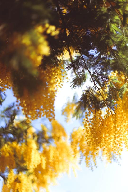
The golden mimosa flower of Menton.
Menton’s historical centre, the old town, is home to a maze of narrow and steep mediaeval streets. Roads that echo the pirates that founded the town in the 13th century, the old town contains a concentration of seven centuries of history.
Nevertheless, Menton has another yellow secret apart from the lemons, it doesn’t belong to two worlds for nothing.
Just as the sensitive lemon trees need full sunlight and warm temperatures, another tree, with the same needs, has also found sanctuary here and put its roots in the earth of Menton and its surroundings. It is the Italian Mimosa Púdica or simply mimosa tree. This exotic and aromatic tree gives masses of fragrant yellow flowers in late winter- early spring. They are abundant in this area around Menton and have become like a second symbol of the region, after its lemon.
The mimosa flower has an intense scent, but it tastes very different to its fragrance. It is frequently used in making chocolate, ice cream, desserts, vines and perfumes in the region. It has long been used as a natural medicine for burns, skin disorders, healing wounds, colds and coughs, as a booster for the immune system, depression, and as a blood coagulant.
The bright yellow mimosa tree also has a nickname: “touch me not”, and is not only stunningly beautiful but its smell is just as divine as its appearance. Together the French golden lemon trees and the Italian bright yellow mimosas have given Menton the best of both worlds.
Personal thoughts
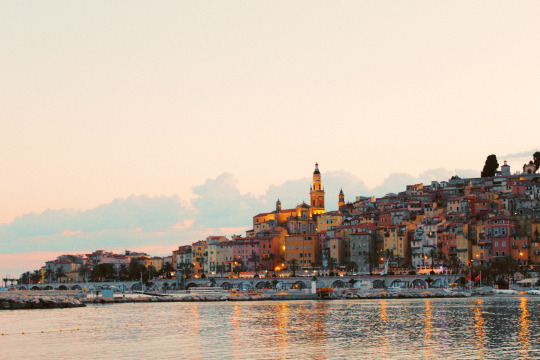
View of Menton from the Mediterranean.
When passing by or walking through the narrow charming streets of Menton what stands out the most is the fragrance of its divine, sweet mimosa flowers, the fresh, strong scent coming from their citrus terraces mixed with the salty aroma from the Mediterranean.
Menton’s little valleys leave it to the breeze to allure travellers and to get attention. The breeze that passes through these valleys carries the divine fragrance of lemon trees and mimosas to far away places, as a reminder of its existence through its unique and distinctive perfume.
Have you ever heard of this city before? Have you visited it before, or would you ever consider visiting?
#writers on tumblr#writblr#writers#original content#travel#europe travel#traveling#france#menton#nice#cannes#italy#lemons#lemon tree#citrus#lemon cake#louis xvi#sun king
4 notes
·
View notes
Text
Alhambra - A Maze of Mystery
Granada’s last proclamation of love to the Moors
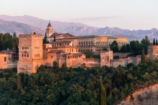
The Alhambra palace complex, Granada
On the secluded Sabika hill, by the lavish banks of river Darro, rigorously protected by the brooding Sierra Nevada peaks and surrounded by a dense forest, lies Granada’s last proclamation of love to the Moors. The Alhambra rises majestically over the vast green plains, resembling a magical vision, for it was built to impress!
This splendid monument with its sturdy and robust outer walls hides a delicate and fragile interior. The emblematic fortified palace started its life as a walled citadel before becoming the opulent seat of Granada’s Nasrid Emirs. Its construction was ordered in the 13th century by the Nasrid Emir Mohammed Ibn Yusuf Ben Nasr, also known as “Al Ahmar”. It is one of the best-preserved palace complexes in the Islamic world and represents Moorish rule in Spain.
Moreover, it was the last Moorish, Muslim state and stronghold in Al Andalus. Alhambra is a construction wonder, so sophisticated that we first now, after 500 years, start to realise, and learn its true potential.
From underground tunnels that snake below the palace’s surface to enigmatic carvings are just now being understood, is Alhambra finally revealing its mysteries?
Alhambra is not just a palace, even though it is often referred to as such, but this place is actually a whole citadel within the city of Granada. It has a complex of different palaces, gardens, passageways, and a fortress. It became the home to the Sultan and his family, as well as the home to the court, and many workers.
The Alhambra is the only extended citadel that still stands today almost as perfectly as it was since the beginning. The colourful name Alhambra originates from the Arabic word; al-Hamrā, which means “the red one”.
There are several reasons for the name, one alludes to the colour of the fortress, which in Arabic is; al-Qal’at al-Hamrā or, “the red fortress”. In addition, the rulers of Alhambra derived from a Berber tribe called al-Ahmar meaning “the red”.
The red palace city is built from Tapia earth, found at the foot of the Sabika hill. The palace complexes got their colour from this red earth, but the surroundings are just as colourful, there is no confusion as to where it got its name.
The old historical path embedded in mystery and a witness to a murder

Wall towers of the Alhambra palace complex, Granada
Having sorted out the origins of the name Alhambra, we can further conclude that this reddish palatial city is beyond the shadow of a doubt a palace of concealed wisdom and ancient secrets, yet to be discovered.
Even though the old historical path of upper Alhambra, leading to the elevated levels of the citadel is commonly known, it is also embedded in mystery and even witnessed an ancient murder.
In the front of the gate ruins, in the oldest part of Alhambra for which any remains have been found, that served as an entryway to the remains of the stone-paved road that once joined the inside of the palace Medina to the outside gates, known as Arrabal. Even though the portal now feels more like a gateway to travel in time, as if it would bring you into the Nasrid’s glorious past.
Here is where the path, scattered with divers towers and named “the promenade of the towers” began. The reason for its name is the fact that this route, which followed the main wall of Alhambra, from the portal gardens to the upper Alhambra passed by a number of towers*. The towers stood out as milestones along the narrow path. The trail started by the tower of the pointed battlements.
*Six of the 30 Towers are named as follows; the tower of pointed battlements, the tower of the Cadí, the captive’s tower, the infant tower, the career corporal’s tower, and the water tower.
The walk intermittently crossed landscaped terraces filled with the Damascus rose, jasmine and trumpet creepers over a fortress wall. From up here, you could also see the pink blossoms and, sometimes if they are blooming, even smell the sweet scent of the crape myrtle trees. It is one of the loveliest views from upper Alhambra.
It was on this same path, somewhere from these altitudes, on the 19th of October 1354, through the dense morning mist that a security guard spotted the young Sultan Yusuf I initiating his daily morning prayer. It was just before daybreak, and even though it was still dark and foggy, he could see from up here how Sultan Yusuf’s bodyguard suddenly launched on the praying Emir with a knife and stabbed him to death, Yusuf was only 33 years old.
It was no coincidence this guard was up here witnessing the murder unfold. In historical times this path was frequented by both guards, military personnel and messengers. The towers served multiple purposes, as accommodation containing bedrooms, as a lookout to guard the inner palace complexes and the outside areas of the citadel from danger, as well as controlling who entered and exited the city.
It also served complex military purposes, but it was also a location for sending and receiving secret mirror messages from far away places. These messages were sent throughout the entirety of al-Andalus forming a complex and sophisticated network of mirror signalling, to exchange information and as an early warning, in case of danger. This practice and way of communication was especially important and vital to the Muslim states in al Andalus during the later periods of its existence.
To receive information as early as possible was key to survival, and the Nasrids rulers of Alhambra were exceptionally progressed and elaborated in these techniques. Alhambra was probably the most advanced of all Moorish states, and as a result of their advancement in the field, they were the last standing Moorish settlement in the Iberian peninsula at the end of the existence of al-Andalus.
The Muslim architects who built the citadel were geniuses, there is no doubt about that. There are plenty of fascinating building surprises hidden in Alhambra. For instance, they used anti-seismic structures in their buildings, well aware that the region was a seismic area. Alhambra was no exception, thanks to its seismic building knowledge it has survived earthquakes for almost 800 years.
They used lead foils in between the columns and the foundations, so whenever there was an earthquake the building followed the movement without collapsing.
The talking walls
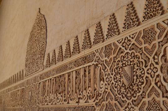
Walls of the Alhambra palace carved with calligraphic text.
The walls can talk, not literally, the walls are not exactly going to speak to you, but the walls of Alhambra do have words carved all over them. The enigmatic inscriptions on the walls are a type of calligraphic decoration as well as they rely on a message, in the form of poems that describe parts of the holy Quran. The palace also used water lilies to create scent in its rooms.
Isn’t it amazing how the sabika hill, Sierra Nevada mountain chain and the rest of al Andalus have lived more time listening to Arabic than they have to Spanish?
For almost 800 years, this place witnessed power and love stories from the Muslim Sultans; but has only witnessed Spanish passion for a little over 500 years. But don’t worry if you don’t speak Arabic, there is always someone to ask who can explain the beauty of these phrases to you.
One of the most interesting facts about the Alhambra is that besides being a giant book, it can also tell you what time it is. The truth is that the genius architects surprise us again with yet another amazing feature, the entire palace complex is perfectly aligned to work as a massive sundial. Just by watching the sun and the shadows in the red palace, you will know what time it is.
At noon, half of the rooms will have shade, and the other half sunlight, so choose your visit time wisely!
The chambers of secrets
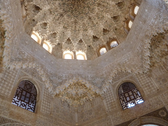
Whispering galleries can also come to be beneath a dome or vault, like in this lovely decorated ceiling in Alhambra.
The Alhambra does actually have its own “chambers of secrets”, also known as the whispering gallery. The reason for its name is, yet another architectural feature, created in the palace.
The Andalusian builders constructed a curation in the ceiling that made the sound travel from one corner of the room to the other, so be careful what you say and to whom you say it too, and don’t share any secrets while you are there!
Something that any engineer or architect lover realises as soon as they step foot in Alhambra is mathematical precision as the main element of construction. The beauty that you will see in this place is all thanks to minuscule mathematical calculations, and perfect engineering and geometry in the structures, decorations and tiles.
However, the original Muslim architects are said to have left unnoticeable imperfections in the decorations and tiles, as they used to say;
“only God can do perfect”.
If you want, you can take on the challenge and try to find some!
A network of tunnels
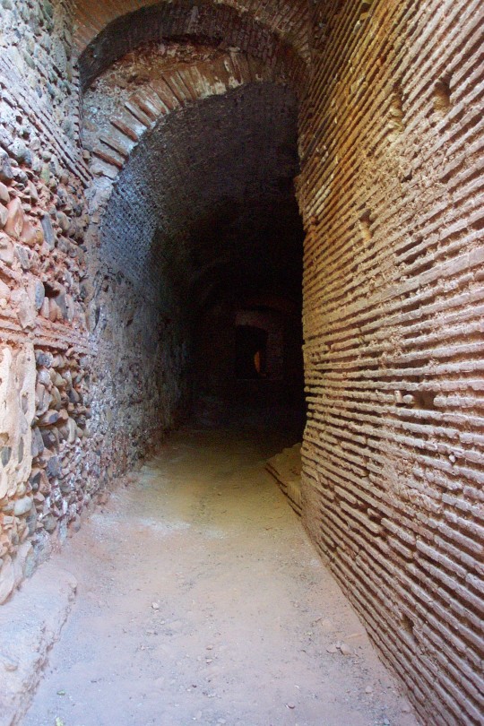
Tunnel in the Alhambra, Granada
Standing on the beautiful square of “Paseo de los tristes” in Granada, with your back facing the old Arabic neighbourhood of Albaicin, you look up at the forbidden walls of Alhambra, the most iconic Moorish monument in Spain. Beneath you, and separating you from this great 10th-century fortress is the Darro river, which gurgles through central Granada amidst lush banks and under century-old bridges.
If you look closer, set into the steep hillside, beneath a gracefully crumbling old townhouse, are small iron gates almost entirely obscured with grass and ivy. These are the entrances to just a few of what is believed to be an extensive network of underground tunnels linking the Alhambra to Albaicin and the rest of the city.
This secret world beneath one of Spain’s most famous attractions has recently made the Spanish news. Even if the track on the dilapidated bank of the Darro river that faces the paseo de los tristes is open to visits, it is only one month a year and only small groups of visitors are allowed.
On one hand, this is because of security risks as these deteriorated, badly kept tunnels can pose a danger to the visitors but also the other way around; mass tourism can damage the already old and fragile tunnel system. They seem set to remain shrouded in mystery and legend, and to keep their dark secrets forever.
However, the extended tunnel network that snakes below the glorious palace-city, would in its time, have served several purposes. The enigmatic subterranean pathways consist of at least 21 underground dungeons, meticulously connected to the ancient underground passages. These dungeons were linked to the outside world only by small openings in their ceilings, and they had access to the earlier mentioned labyrinth web. The caverns are believed to have served as storages for, amongst other things, grain, wheat, and other necessities.
As for the entire labyrinth of tunnels; it would have allowed the residents of the palatial city to come and go unseen, especially important during sieges and as a last resort for the Moorish rulers, in need of urgent escape.
The secret underground network of tunnels would prove to be of utmost importance when the Moorish rule came to its end, and the Nasrids lost their grip on power and abruptly faced their downfall. As the 800 years of glorious Moorish rule was over, everyone remaining with a dissimilar opinion to the new re-conquers faced harsh retribution, and was either killed, exiled, or underwent the most horrible torture imaginable. The country entered a very dark and eerie time period, a time that struck terror into the rest of the known world and shook it to its core.
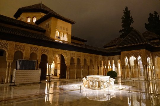
Court of the Lions by night, Alhambra, Granada
The beauty and splendour of the Nasrids palace city is incomparable to anything ever seen. The mathematically calculated architecture combined with the sophisticated fragile artwork, ornated with fine details, rough robust walls and delicately decorated pillars everything is in perfect balance, in a divine harmonic symphony!
Alhambra radiates sophistication, elegance and mystery, a greatness that words fail to describe. A superior jewel beyond comparison.
But with great beauty comes great pain.
#history#writers on tumblr#writblr#writers#original content#travel#spain#alhambra#Al-Hambra#granada#moors#moorish#nasarids#nazarids#nasrids#court of the lions#palace#palace complex#tower#towers#wall#arabs
30 notes
·
View notes
Text
The Canary Islands: The secret of the xaxos, the Guanche mummies in the ravine of the dead
Gran Canaria, The Canary Islands
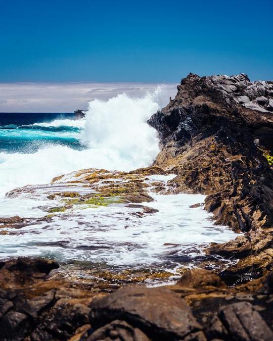
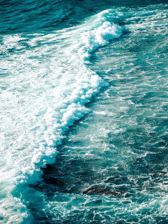
The waves of the Atlantic Ocean are persistent, they keep hitting the sharp edged cliffs, time after time.
As a perpetual punishment they insist on coming, violent and wild, as if they want to reshape the entire coastline.
It has been going on for thousands of years and will continue to do so until the ocean, wind and rain shape all the cliffs round, as erosion eats on the volcanic rocks reducing them to black sand.
Breaking the seal of the cave of a thousand mummies
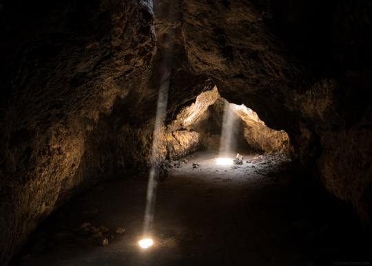
How the caves might have looked like
The tireless dance of the waves, their determination and the distinct smell of the salty ocean could even be noticed from up here, on the high cliffs in Barranco de Erques looking down on the Atlantic.
It is here history is about to be written, as three resolute men walk down the narrow path leading down to the Ocean.
They are here to meet up with some locals, who promised to reveal a secret.
One of the men suddenly stops and looks up at the looming face of the enormous rock, it is as if it’s staring back at him, bewitching him with its treasures.
The rock holds hundreds of caves, built over centuries from the lava flows of Mount Teide in Tenerife.
Any of them could be the cave they’re looking for.
A sharp, loud whistle wakes the man up from his daydreaming.
The source of the whistle came from one of the four locals who were going to lead the way to the treasure.
The seven men continue their dangerous route in between the ravines and the sharp volcanic mountain side that frames the trail.
After a long walk seemingly leading to nowhere the locals stopped, without warning and started to break stones away from the opening of the sealed cave.
Suddenly opened before them, a chamber, holding the promise of a journey to the island's past.
At first it was too dark to see anything, even the torch and the thin ray of light coming from the broken seal in the cave’s opening, were not enough to light up the spacious, pitch black cave.
But when their eyes got used to the darkness, marvellous things started to appear.
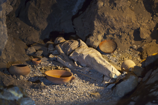
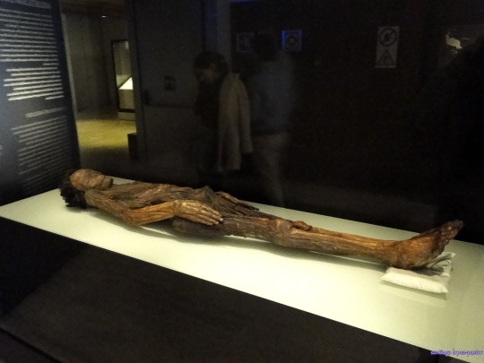
A thousand xaxos, Guanche mummies, laid in front of them.
These were not the first mummies to be unearthed on the islands, but it was certainly the cave with the greatest number of xaxos ever discovered.
The cave was embedded in complete silence, as it had been for centuries, but if you listened carefully, with your heart, its walls and everything inside the necropolis was telling stories of the past.
The mummies were mute but the cave was speaking in their stead.
A story of a son's last farewell to his father, a grieving family’s last moments with their loved one, before leaving and wishing he could have a peaceful rest.
But only the xaxos knew if their rest was peaceful, not everyone got to rest in peace, and in contrast with everything else in this cave they could not speak.
They looked asleep, but they were frozen in time, still tied to a faraway past, when they were brought here.
The cave of wonders had spoken and revealed precious moments, and had proven to us that the “primitive” Guanche population were warm hearted, kind, it further showed that they sincerely cared for their dead, preserving the deceased for eternity.
Replica of a Guanche mummy, Tenerife
After having inspected the precious content of the necropolis and written down the historical accounts and observations, the men took a few mummies with them, for studies, resealed the cave and disappeared.
The location of the cave remained a scrupulously guarded secret. And there was no record of it anywhere, which only served to increase the public's curiosity and elevate the mystery to an apex.
Locals maintain they don’t disclose the location in order to protect the memory of their ancestors, who rested there, the Guanches.
This stunning cave was found in 1764, by Spanish regent and infantry captain Luis Román, the writer José Viera y Clavijo and a contemporary local priest.
The writer described the finding in a book on the island's history: A wonderful pantheon has just been found, so full of mummies that no less than a thousand were discovered.
And thus the legend of a thousand mummies was born, the place where it was found in the ravine of Erques, became known as “the ravine of the dead”.
Erques; ravine of the dead
Curiously, the writer Clavijo who summarised a report of the finding, omitted the location. If his intentions were to protect the cave from plunder, he regrettably failed.
The rumours and mystery of the cave “of a thousand mummies” got the better of some looters and by 1833 multiple sources confirmed, very few bodies remained.
But the precious few from that cave and other similar caves that remained intact are now held in museum collections helping us unravel the unanswered stories about the archipelago and its first inhabitants, and to fill in the empty spaces in history.
As the Castilian conquest of the islands almost completely erased the Guanches from history, we are left with questions, questions that until now remain unanswered.
One question we do have the answer to is: How did the Guanches preserve or mummify their dead?
Preparing their loved ones for eternity
The method they used for preserving the corpses for their battle against time and nature was surprisingly simple.
It is the same method being used to preserve food.
Their bodies were treated with dry herbs and lard, and were left to dry in the sun then smoked by fire.
It took fifteen days to prepare a xaxo (mummy), compared with 70 days for an Egyptian mummy, besides the two methods are fundamentally different.
Some of the Guanche mummies have withstood the battle of time better than the Egyptian ones.
Guanche mummy
The definition of its muscles can still be observed, and the hands and feet in particular are outlined in detailed relief, like a wooden sculpture.
But the most significant difference in the finding was hidden: unlike its Egyptian counterpart, the Guanche mummy had not been eviscerated.
Its organs, including the brain, were perfectly intact, thanks to a mixture of minerals, aromatic herbs, bark of pine and heather, and resin from the native dragon tree, that halted the bacteria and thus decay, inside out.
Later the family of the deceased handled the xaxo, placing it in a cured and carefully stitched bag made of animal hide, usually goat.
The number of hide layers corresponded to the person’s social status. The practice was not limited to Tenerife. Mummies have also been found on neighbouring Gran Canaria island, decorated or painted in multiple hues, wrapped in a reed mat, and then deposited in hollow tree trunks.
Corpses also have been found there in funerary caves. More than mummies, the xaxos resemble wooden statues.
A pact with eternity
Cave by the ocean
The mummification process started with the washing of the deceased twice a day with cold water or boiled and cooled water infused with herbs or with salty water from the ocean, the methods varied from different time periods.
Especially the weaker parts of the body were thoroughly washed, as armpits, ears, in between the fingers, nose, neck and pulse.
In the Guanche society the embalmers or “achicasnai” (in Canarian Berber), belonged to the bottom layer and they were not looked upon well because of the nature of their work.
They lived an isolated life, as people perceived them as contaminated by death.
With time they developed into some kind of priesthood, with knowledge of secret rituals and mummification.
Once the xaxos were embalmed and ready, they were taken to caves, in ravines, cliffs and mountain sides, places with difficult access, to make sure they were left to rest in peace.
Sometimes even ropes or ladders were needed to get to the unreachable caves.
The caves were generally spacious, to be able to accommodate large numbers of collective burials, individual burials were rare.
The deceased were placed horizontally in the centre of the cave. Each body had its own private space and was separated from the floor of the cave by a wooden bed, made of pine wood or savin.
There are also cases where the xaxos were put in a simple coffin of wood, possibly reserved for socially higher ranked personalities, like Menceys (kings) or tribe chiefs.
Foetus mummies
Mocan, used for mummification
Hidden in a volcanic tube in Guía de Isora, Tenerife, the remains of two foetus mummies were found, at a height of 1.400 metres above sea level.
The reason for such burial was probably that the location was “safe” and isolated.
The cause of death is unknown, but usually prenatal deaths in prehistory were due to prenatal problems or complications during birth.
The xaxos, mummies, were discovered by coincidence as two hunters were searching for an unusual kind of spider that lives in caves and volcanic tubes.
The hunters entered in pursuit of the spider and by chance found the two mummified foetuses.
This is a perfect example that not all mummies were buried closed by the sea or in similar locations.
As everything else on these mythical “fortunate islands” the mummification process and burials vary from island to island and from one time period to another.
Just like when the Guanches first arrived on the islands, they didn’t come from the same place(in North Africa or Maghreb) nor at the same time.
The population in each island have their own peculiarities, so the archipelago is not homogeneous.
The island's history is distant and faint, we are as usual left with more questions than answers.
The lack of historical documentation and records makes the scientists and archaeologists work very challenging, for to be able to get anywhere they will have to look deeper.
The answer may lie within an unexplored cave, a necropolis or an etching. The island's topography, its gullies and ravines, hardened lava flows, caves and wind blown sands, all helps to preserve those secrets.
Comment
Back in the fable cave “of thousand mummies”, whose location was lost in history and from which its occupants had been plucked, a feeling of desolation rules.
After revealing its secrets, the cave is now silent, it is empty and submerged in darkness.
It was here history was once written, but where history ends legend begins, to fill in the empty pieces of forgotten history.
The mystery of the Guanches remains, they took their secrets with them as they disappeared, these souls that for centuries populated the islands.
Some of whom came in silence to this dark, inaccessible, funeral cave, with the intention to rest, beside the reassuring sound of the Ocean waves, perpetually, in a pact with eternity.

Fuerteventura, The Canary Islands
Further reading;
Álvarez Sosa, Tierras de las momias (Lands of the Mummies)
Emma Lira: Búscame donde nacen los dragos.
(A historical novel set in Tenerife)
Sources;
Cátedra de Tecnologías Médicas de la ULPGC, Gran Canaria.
Historia Guanche, Universidad de La Laguna, Tenerife.
A long personal connection to the islands.
#history#writers on tumblr#writblr#writers#original content#travel#spain#gran canaria#tenerife#lanzarote#fuerteventura#la palma#la gomera#el hierro#mummies#mummy#legends#mummification
1 note
·
View note
Text
Canary Islands: The escape across the ocean of darkness
Tenerife, the Canary Islands
Thousands of years ago Berber tribes, amongst them the Canariis, arrived from Northwest Africa to the fortunate islands (the Canary Islands).
As the islands had an important strategic position that offered great trade possibilities as well as hosting passing by ships, offering them a safe haven in stormy weather and plenty of provision originating from the rich volcanic earth the islands offered.
The Guanches, the first known inhabitants and natives to the islands, lived a good life for thousands of years, until the Castilians (Spaniards) attempted to conquer the archipelago, after having failed to conquer North Africa, and they shifted their plans and decided to conquer the Americas instead.
To succeed in this prospect they needed to conquer the Canary Islands first, as the location served as a natural bridge between continents thus making a perfect base for their expansion expeditions.
The wars for the islands lasted for hundred years and proved to be much more tough and complicated than first anticipated.
But when the downfall finally came it brought with it a long line of horrific consequences.
The Guanches were enslaved, humiliated and systematically killed in terrible ways.
The remaining aboriginals had only three options; to submit, to run into hiding in the inaccessible mountains or to flee across the Atlantic.
Bentor, the last Guanche king in Taoro, Tenerife, met a sorrowful destiny, putting an end to thousands of years of Guanche rule.
But it was the beginning of a new story, following the Guanches in their struggle across the Atlantic and towards a new life with new adventures in the new world, faraway from their ancestors and their beloved islands.
A ray of hope
Guanche
The small family “Aday” had been walking through the pine wood covered mountains and dense laurel rainforest, seeking cover, for two and a half full moons (two and a half months).
It had been hard and challenging, they were surviving on fruits, herbs and roots or what nature could offer.
Haridian’s husband, Atacaicate was a herb collector, used to the dense forests and inaccessible terrain on the mountains of north western Tenerife, he knew his way around well.
From time to time he caught a rabbit, a bird or some other small animal they could eat.
Haridian was most concerned about Airam, their two year old son.
She wanted to make sure he got enough food and stayed healthy.
They were hiding from the Castilians, who five months earlier conquered Taoro.
Large parts of their neighbours and villagers had either been killed, enslaved or shipped away to unknown destinations.
The situation had gotten so bad that staying in the village would have gotten them into great danger.
Atacaicate’s (his name means “big heart”) father was killed earlier that year, that was when his brothers decided to use their precious trade connections to try to escape, over the sea of darkness, to save both their and their families life and honour.
The rest of Atacaicate’s family had already left and they had taken Haridian’s father and sisters with them, her mother died long ago.
Haridian and Atacaicate couldn’t join them, as Airam (meaning “freedom”) was seriously ill at the time.
But Atacaicate’s brothers promised to arrange another ship, to come and get Atacaicate and his family three months later, on the first day of full moon.
They were supposed to wait for a signal, at Tacoronte beach, hiding behind the cliffs.
Atacaicate got his profession as herb collector from his father the great “ Achxuraxan Aday”, who started out as a herb collector, then developed great knowledge in curing diseases, as a result he worked in his later years, as a doctor at the royal court, while his sons collected herbs, in his stead, from the mountains.
Pico del Teide, Tenerife
Atacaicate also learned about medicine making and how to cure illnesses from his late father, and he had been able to cure little Airam’s illness, the boy was now completely cured.
As Airam was cured and only two weeks remained before their departure, they started to close up to Tacoronte through the lavish rainforest, they slept in caves by night and walked by day on the route to their destination.
It was funny, when Haridian was born her father, who was a shepherd, decided to call her Haridian partly because the name is related to shepherds but more importantly because the Guanches used to give young girls who were born during the full moon that name, as it meant “Moonlight”.
Maybe that would bring them luck now, on the first day of the full moon, to depart safely and arrive well in the new country (Cuba).
Two weeks later after walking through lush rainforest and steep mountain cliffs they reached Tacoronte.
From the mountain cliff the view was spectacular, they settled down and waited patiently for nightfall to come.
The pale moon was not enough to lighten up the pitch dark bay, and the only thing you heard was the squeaking sound of small animals or insects in the vegetated areas and the reassuring sound of the ocean.
Haridian started to get anxious, would they be able to leave? Was it the right place? They were so close, yet it seemed unreal, her heart was pounding faster and faster.
Airam was asleep when they heard the sound of a small bark.
Was that the one? Haridian and Atacaicate stayed quiet behind the rock, then finally they noticed the promising sound of “el Silbo” (the Guanche whistle language), and they hurried towards the small row boat.
Twenty minutes later they embarked a ship that prepared right away to depart.
As the ship began to move, Haridian and Atacaicate stood in the back of the ship, looking at their island disappearing, forever. devastated but simultaneously relieved, as they were safe now, they realised they belonged to the lucky few.
One month and ten days later they arrived at Bariay on the east coast of Cuba, now a new chapter in their lives was about to begin.
Tenerife, the Canary Islands
*Based partially on historical accounts, legends and folk stories.
The Canary migrations, a new future
The systematic killing of the Guanche population resulted in that ,roughly estimated, 75% of the aboriginals were eradicated. The Spaniards had later difficulties populating the archipelago again, no Spaniard wanted to travel that far or to live on an isolated island.
The ones remaining were either enslaved, hid in the mountains or a few lucky ones were able to escape across the Atlantic Ocean or elsewhere.
This last option was possible thanks to the ancient trade relations, friendships they made in the past.
Beach in Cuba
It was certainly no coincidence many of the fugitives chose Cuba as their final destination and new home, the reasons were many.
Once an islander always an islanders, the Guanches who arrived in Spanish America called themselves “Isleños” (islanders) as they were also referred to by the Latin Americans at the time and still are today.
It must have felt most as home in Cuba, surrounded on all sides by the familiar Atlantic Ocean.
Another reason for choosing Cuba was indeed the fact that family and friends, who arrived earlier, settled down there and formed a tight Canarian community.
The Guanche immigration to Cuba began in 1492 with the first ship of immigrants arriving on the 27 of October 1492, at Bariay on the east point of Cuba.
Havana, Cuba
Their numbers were so great that the enormous Canarian migration to Cuba resulted in that 50% of all marriages at one point in history in the whole of Cuba was to a Canarian. As there was no end to the Canarian refugees, the Cuban government had to forbid any further Canarian migration and the canarians were forced to look for an alternative migration destination.
Many of the newcomers worked in the tobacco industry, where they helped the Cubans build up their prosperous tobacco commerce.
The first Cuban writer was isleño, and born in the Canary Islands.* see end article.
The Canarian descendents preserved their culture and traditions through celebrations of various cultural festivals.
An example is the festival of Canarian traditions held annually and the contest called: Princess Dácil, in honour of the Guanche princess.
Cuba owes much of its speech patterns and accent to the heavy Canarian migrations, a lot of ancient Guanche words, as well as more modern Canarian Spanish was absorbed into the Cuban Spanish until the two languages almost fused together.
Francisco de Miranda in Avenida Paulista
Venezuela was the second biggest migration destination, where many respected politicians and presidents were descendants of the Guanches.
Francisco de Miranda was a Venezuelan military leader and revolutionary.
He epitomised the international importance of the American revolution, yet few Americans would recognize his name.
He fought the British in the Caribbean and Florida during the war, and in this way helped the US to win the revolution.
His father was:Sebastian de Miranda Ravelo, a Canarian immigrant.
He began the Spanish American wars of independence, and paved the way for another great man with Guanche blood as well, the liberator Simón de Bolívar, who liberated or assisted in the liberation of four territories, from the Castilians; New Granada (1819), Venezuela (1821), Quito (1822), and Peru (1824) as well as establishing-Bolivia (comes from Bolívar).
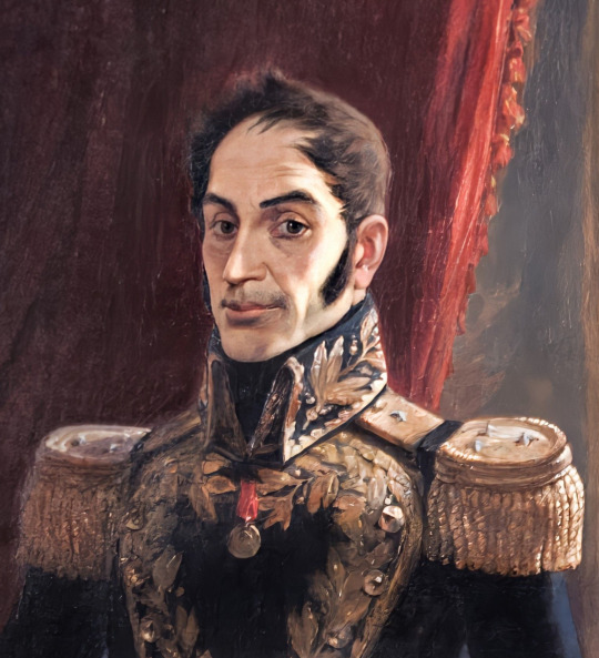
Simón Bolívar
The Canary influence in the US
Some of the isleños immigrated to the US, where the city of “San Antonio” was founded by people from the Canary Islands.
When you remember Alamo, you should also take a second to remember the Canary Islands.
The city was originally founded by settlers from the Canary Islands and their descendants died fighting alongside Jim Bowie and Davy Crockett.
Even the founder of Sāo Paulo was from the Canary Island of Tenerife.
Both Texan and Mexican cuisine as well as Cuban, of course, trace their roots back to the Canary Islands, as the Guanches brought with them their cuisine in their desperate escape across the Ocean.
Like chilliest peppers and their “mojo” sauce that later became the key sauces and salsas in those cuisines.
In spite of their great successes in their new homes, life was not easy for the ileños.
The Europeans saw them as Spanish, the Spanish regarded them as hybrids, not Spanish not Latin Americans.
The Latin Americans perceived them as foreigners.
The fact that they didn’t fit in anywhere may have contributed to the Canarians becoming “trouble makers”and revolution leaders.
The few surviving Guanche surnames
The Canarians were scattered around the world, trying to survive the best they could.
Back in Spain it was a custom when a Guanche converted to Catholicism to take a Castilian name, that is why many of the Canarians have Castilian or Spanish names.
However, there are seven Guanche surnames * see end article. that have still survived, until now.
Six of them are authentic Guanche names, the seventh, Tenerife, was given to the Guanche slaves, as a last name referring to their island of origin, when sold or brought along to assist the conquers in Latin America.
Today we find 50.000 people worldwide (Canary Islands excluded) carrying one of these seven Guanche names that somehow have survived over time.
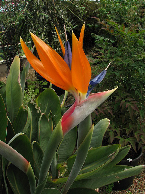
strelitzia reginae; flower of fire, or paradise bird
As the Canarian economy has improved drastically since the 70s, especially thanks to the flourishing tourism industry, as many Europeans “survive” the cold, depressing winters thanks to the island's “eternal spring”.
The cultivation of fruits, vegetables and exotic flowers makes excellent export products to frozen Northern Europe.
Together they make up the lifeline for the islands and the reason many Canarian families return home after many, many years in exile.
Conclusion
Beach at the Canary islands
The colonisation of the Canary Islands by the Castilian crown led to the gradual physical destruction of almost the entire indigenous society and the irreversible disappearance of the indigenous culture and history as a whole.
The Guanches were extinct, erased from history by a unforgiving, irresponsible conquest genocide, caused by an unstoppable hunger for riches.
We were left with unanswered questions, a whole in history and a blank page that can not be filled nor replaced.
The genocide of the Guanches remains an enormous and unacceptable moral stain on European colonial traditions.
The Canaries went from being conquested and plundered to become an autonomy.
Will the islands ever be free? Well, nothing in this life lasts forever, nothing is permanent, the future will be our witness, and their enemies are geography and time.
The Guanches no longer exist, however, they still have a presence on the islands, as subjects of speculation, an unsolved mystery and a source of discussion in our modern era.
The stories of the ones who disappeared but remained, remained somehow between us, and in our hearts,” the presence of the absent”.
The Guanches will be remembered through their legends, forever trapped in between volcanoes and legends.
It is our responsibility to keep their memory and their stories alive and help others remember them.
*The first Cuban writer born in the Canary Islands: José Martí Gertrudis Gómez de Avellaneda Silvestre de Balboa.
*The seven Canarian surnames that still survive; Baute, Bencomo, Chinea, Guanche, Oramas,Tacoronte and Tenerife.
Sources and further readings:
Book:The Canary Islands Migration to Louisiana, a fascinating history in both Texan and Canary Islands history. Containing a passenger list of the isleños volunteer recruits and their families that filled eight vessels that brought Canary islanders to Louisiana between 1778 and 1783, you won’t find a more interesting book detailing this unique chapter in history.
The Canary Islands: A cultural history, a thorough history book for the development of the islands.
The Canary Islands:A cultural history, a different book by the same name. A travel guide.
Lonely planet, Canary Islands, Guide book sharing tips on hidden gems on each island, places to stay etc.
Canary Islands 25 secrets: A local’s guide.
Balbuena, Castellano, José Manuel (2007).
La odisea de los Canarios en Texas y Louisiana (in Spanish).
Further information and inspiration from a long, close personal relation and knowledge of the islands.
#my writing#history#writers on tumblr#writblr#writers#original content#travel#spain#the us#america#south america#cuba#the canaries#canary islands#gran canaria#tenerife#lanzarote#fuerteventura#la palma#la gomera#el hierro#simon bolivar#fransico de miranda#fidel castro
0 notes
Text
Canary Island: Stormy waters and a century long war
Stormy waters, Canary islands
It was mainly the desertification of North Africa and the increasingly dryer and harsher living conditions there that drove a group of Berber tribes, from modern day Morocco, to search for a better future.
The migration brought them to “the islands of the blest”, the Atlantic Canary Islands, at some point after 6000 B.C.
They were experienced in agriculture and sheep herding, they easily adjusted to the prosperous, uncomplicated living conditions these islands offered.
After resolving the issue of fresh water they settled in, and as they did so they discovered that the islands offered an enormous amount of wild plants, herbs and fruits that also served as medicine.
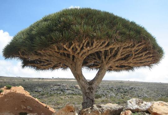
Dragon tree: Can live for thousands of years (1.000-6.000 years), its sap is as red as blood, and was used by the Guanches for painting, and in mummification processes.
The international trade relations that will become of utmost importance for the future
The flora on these “fortunate islands” is in some aspects similar to the African, but has much more variation and includes species non existing elsewhere.
Here the Guanche population, native Canarians, lived a peaceful life for thousands of years, not completely alone though as they had regular contact with traders and others from far away Empires, looking for a trading partner, seeking refuge from storms or in need of provision before undertaking a dangerous journey ahead.
As sailors soon discovered, the archipelago had an important strategic position as a bridge between continents, the European, the African and the American.
There is no doubt the Guanches prospered from their role as host and business partner.
The Canary Islands are in fact a huge subaquatic mountain chain, as high as 7500 meters from the bottom of the ocean, with its tops sticking out as islands from the water.
These volcanic islands, born out of volcanic fire, have steep cliffs and rugged coastline that acts as a natural protection, a kind of fort.
Moreover, their trading partners and visitors saw the Guanches as an ally or as a diplomatic asset, not as an enemy.
So, life went on for the native Guanches, they profited from the island's strategic position, abundant nutrition, reliable trading partners, enough drinking water and with the ocean and the rough sea coast as natural protection.
They lived a great life for thousands of years on these paradise islands.
As a description of the population we have this historical account made around 1150 A.D. by the Arab geographer Muhammad Al-Idrisi in the Nuzhatul Mustaq, a book he wrote in which he reports a journey in the Atlantic Ocean made by “Mugharrarin” (adventurers) a family of Andalusian sea farmers from Lisbon.
The only surviving version of this book is kept at the “Bibliothèque Nationale de France”, reports that, after having reached an uninhabited island (Madeira) where they found a huge quantity of sheep, which meat was bitter and un edible.
They later continued southward and finally reached other islands where they were soon surrounded by barks and brought to “a village whose inhabitants were fair haired, with long and flaxen hair and the women of a rare beauty”.
Among the villagers one did speak Arabic and asked them where they came from.
Then the king ordered them to bring the foreigners to him, where they were surprised to be welcomed by the Berbers.
Apart from the marvellous and fanciful story it would also prove that the Guanches had regular contact with visitors from far away and spoke foreign languages.
Amongst the visitors and traders were the Numidians, Ancient Egyptian, Phoenicians, Carthaginians, Romans, Greek, Andalusians, Arabs and later on the Latin American.
These international relationships will come to play an important role in the future of the islands, “a friend in need is a friend indeed”.
The description of the Guanches

The Guanches
The Arabs, who had an exceptional good relationship with the aboriginal inhabitants of the oceanic archipelago, as business partners and friends have a detailed description of the Guanches, their accounts go on recounting them as typically tall between 175-188 cm, many having blond long hair and blue or green eyes with a strong physique and generally very healthy.
They describe their character as brave, intelligent, dignified, friendly and modest.
The Guanches particularly loved singing, dancing and contests.
Moreover, they were known for their warmth and their deep respect and love for their families.
The Arabs called the islands “Khaledat” (everlasting islands)
The Greek thinkers, in turn, believed that the mythical garden of Hesperides was located on the Canaries.
In their minds they pictured the islands as a heavenly garden in which the Hesperides, the daughters of Atlas, would guard the golden apples that grew on the trees.
This golden fruit granted immortality when eaten, and Hercules (semi god and son of Zeus) tricked Atlas himself to pick them for him.
To the ancient civilizations the archipelago was exotic and desirable, a paradise on earth.
Their fascination for the islands as a garden of paradise, as blessed, fortunate or eternal is understandable considering the exceptional beauty, amazing scenery and peculiar flora of the island chain.
Their conviction of them being exotic and special probably had something to do with their distinct flora and fauna, like the dragon tree and the giant reptiles, that were found only here.
The unusual dragon tree can live for thousands of years (1000-6000), its sap is red as blood and was used by the Guanches as paint.The Greeks were convinced they hid a dragon inside the trees.
Many of the rare types of herbs that only existed on these blessed islands, served as medicine and became an important trading product.
Trouble in the horizon
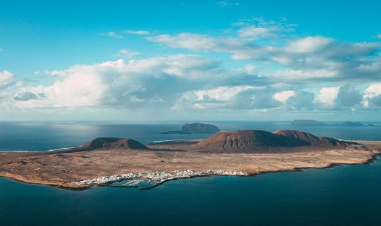
Lanzarote beach
Far away, in the north east, an event was about to take place, an event that was going to change the history in the Canaries and the rest of the world, forever!
It was the Iberian peninsula that saw historical developments that came to have unprecedented consequences, and would change the course of history, not only for Europe, Africa and America but practically the whole world would suffer the consequences of these events for centuries and centuries to come.
France had long felt threatened from the Moorish, Arabic rule in Al Andalus, apart from that they suffered hard economic times including several famines, in an attempt to eliminate the Moorish rule in the Iberian peninsula and solving their economic issues in one go, they started an evil and ambitious scheme in collaboration with the Christian northern provinces of Al Andalus.Castilla and León were united through the marriage of Fernando and Isabella.
Together they started an aggressive campaign pushing southward and killing or exiling anyone in their way, different opinionated or with a dissimilar religion, they had zero tolerance!
This extreme action of violence continued for years until it finally eradicated the Moorish, Mozarabs, Muslims and Jews and everyone else different from the Catholic Castilians.
There was without any doubt a hunger for Al Andalusian riches, a hunger that never stopped, the colonisation was born!
After having demolished Al Andalus, yet still hungry for more, the Spaniards and the Portuguese aimed to colonise North Africa.
Nevertheless, such actions were unacceptable to the Ottoman Empire and the powerful Algerian fleet that held total sovereignty of the Mediterranean waters, and the task proved to be impossible.
Instead their interest soon shifted to colonising the Americas, but to succeed in that mission they needed a bridge or a base from which they could launch their expeditions.
The first step in conquering the Americas was to control the Canaries, by colonising them first!
The conquest of the archipelago
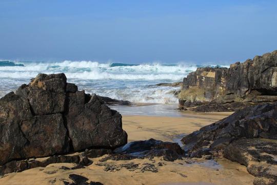
Fuerteventura, The Canaries
The Spanish conquest of the Canary Islands began in 1402, with the expedition of the French Jean Bethencourt and Gadifier de La Salle to the island of Fuerteventura and Lanzarote, as a first step.
They were sailing in the proximity of the islands for a while, waiting for an opportunity to invade.
The opportunity presented itself as harvest had failed several times in a row and the situation of the Guanches had turned desperate, the aggressors took their chances and the unfortunate islanders reluctantly surrendered.
The other five islands fought back, and the colonists were in for a long, tough fight.
The Guanches were undoubtedly superior physically, they were intelligent and knew the terrain well.
Besides they had a secret weapon, a weapon that would be of extreme value during the century long war that followed.
The Guanches had amid their years on the islands, due to the geography of the place and its inaccessible terrain, developed a whistle language or “silbo” as a way to facilitate communication.
The silbo could be heard up to 5 km away throughout rough mountainous terrain and was originally used as an everyday way of communication.
Now it proved to be a valuable asset as a weapon in the hundred years of warfare, to exchange information and to send secret messages without the enemy even noticing.
As always when it gets tough or things get out of hand, unethical behaviour and malicious tactics start to be used.
In the case of the Canaries, as the conquest was supposed to be easy but proved to be anything but, the invaders built a settlement with a fort on the first conquered island.
From there they launched raids and pirate attacks, partly to capture slaves from the five remaining islands, but also to cause tribulation in an attempt to cause a separation between the nine kingdoms, of the largest island, to make them turn against each other.
With time, the remaining islands fell one by one, the next one to fall was El Hierro followed by La Gomera and La Palma, the two major islands posed the biggest challenge.
However, after extensive battles Gran Canaria was finally subjugated, although the aggressors had realised by then that the only way to conquer the last and largest island, Tenerife, was by turning its inhabitants against each other.
During the course of history the islands were divided into kingdoms or “Menceys”.
Tenerife being the largest island it was divided into nine kingdoms, from which the richest and most powerful one was the northernmost kingdom of Taoro.
The leader of a kingdom was “the Mencey”(king) who had ultimate power in the kingdom.
In Tenerife the throne was decided by election whilst in Gran Canaria it was hereditary.
By turning the different kingdoms against each other the aggressors hoped to facilitate and speed up the conquest.
The Guanches were the native inhabitants of the islands.
The word Guanche derives from the language of these aboriginals, the so-called Canarian Berber, a language that disappeared along with the conquest except for some words.
In this language the word Guanche was originally called “Guanachinet '' literally translated to “person from Tenerife” Guan= person + Achinet = Tenerife.
The term Guanche is usually used nowadays referring to people from the entire archipelago.
Antón Guanche
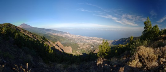
Orotava Valley
Antón Guanche was a Guanche native of the southern parts of Tenerife.
According to historical accounts, Antón was captured, as a boy, around the year 1420, off the coast of Güímar, southern Tenerife, by European settlers on the island of Fuerteventura, who carried out slave raids on the un conquered islands.
After a few years he was unexpectedly released and returned to Tenerife, receiving his freedom on the condition that he would influence his compatriots on the island.
This is an example of the strategy used to turn the islanders on each other!
Antón later served as a translator under the name Antón Bolaños.
When the Spaniards prepared to invade the last island standing, the southern kingdoms of this island joined the invaders on the promise of wealth from the much richer northern lands, a promise that was never fulfilled but the Castilians (Spaniards) betrayed them, after securing their own victory.
The first battle of Acentejo
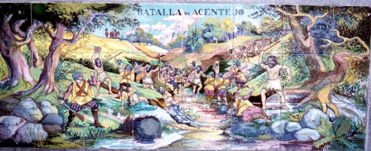
Tile mural in Municipal Park, Santa Cruz, Tenerife, Battle of Acentejo
When the time was ripe, the action began with the Spanish army’s arrival on the northern coast of the island, the battle of the rich north kingdom of Taoro started with the invading troops advancement through present day “San Cristóbal de La Laguna” to an area known as “Acentejo”.
The Castilians committed the terrible blunder of walking blindly into the ravine now called “barranco de San Antonio” ; its original Guanche name was “Farfan”, in Acentejo.
Despite their technological superiority, the Spaniards, protected with armour and shields, fought with blunderbusses and cannons, the Guanches, fighting naked attacked them from the slopes with stones and spears of hardened wood, known as “banotes”.
The Castilians were unable to manoeuvre with their horses, as the slopes were covered with very thick, arboreal brush. The Guanches that numbered some 3.300 men, under the leadership of Mencey Bencomo and his half brother Tinguaro, chief of the Acentejo region, made use of their mobility and intimate knowledge of the terrain to gain the upper hand.
While Tinguaro took 300 men and ambushed the vanguard of the invading forces, Bencomo arrived at the battle with 3.000 remaining men, attacking the rearguard of the already dispersed Europeans.
It is believed that four out of five Spanish soldiers fell in this battle, leaving 1.000 dead on the battlefield out of the initial 1.200 men.
The victory was total, however, Fernández de Lugo, the Castilian general, although wounded, escaped with his life and returned to Gran Canaria disguised as a soldier, but he would be back, later on, after he sold all his possessions to be able to finance a new campaign.
A town was built on the site where the battle occurred that also has a mural, commemorating the great victory.
The battle is known as: the first battle of Acentejo or “La matanza de Acentejo” (The slaughter of Acentejo) and it took place on 31 of May 1494.
Spirits were high on the Guanche side, and the population were proud of their brave fighters.
This was by far the greatest victory in the history of the archipelago, to the extent that it became a symbol of the greatness and bravery of the Guanches.
On the other hand it was one of the worst defeats the Spanish Atlantic expansion and its forces ever experienced, both in terms of casualties and humiliation.
In this battle that took the life of four in five Spaniards there was a story that played out in the aftermath of the fights known as Canarias Pocahontas.
Princess Dácil - The Canarian Pocahontas
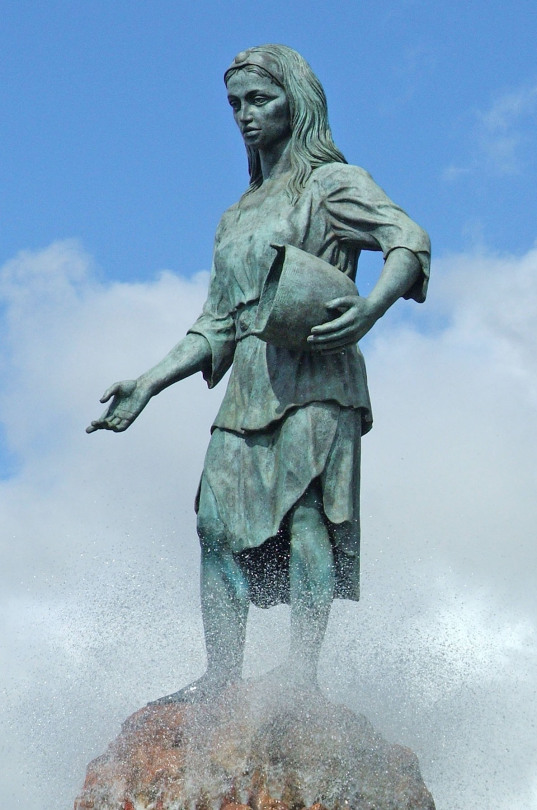
Princes Dácil
Dácil or Dácila was born in the ancient Menceyato (kingdom) of Taoro (Tenerife), during the early second half of the fifteenth century.
She was the daughter of the, earlier mentioned, great Mencey Bencomo, and admired throughout the kingdom for her beauty, like many aboriginals she had long blond hair and green eyes.
She was initially intended to marry Duriman, a noble native Guanche.
However with the arrival of the Spanish invasion and its fleets, there was amongst others a captain called Fernando García del Castillo, a Castilian officer of a cavalry unit, during the already mentioned battle of Acentejo, where the Castilians were slaughtered and most died, Captain García miraculous survived although seriously injured, he was taken prisoner and placed under the care of princess Dácil, she was to look after his wounds he suffered in the battle.
According to several historians, the captain acted as a diplomat providing services between the Guanches and the invading forces and was even honoured with some estimates by king Bencomo of Taoro.
Rumours began to surface that the captain and Dácil were lovers, they were believed to have been spoken alone, a practice strictly forbidden by Guanche law.The princess was imprisoned but later freed, the rumours had blemished her image and without further options, she later married captain García.
Her name is one of many Guanche names that, fortunate for the Canaries, have not been lost; there are still women called Dácil throughout the archipelago today.
Their marriage was later considered as a bond of brotherhood between the Guanches and the Spaniards, even though after all the misery the Guanches were put through, no one but the Spaniards believed that.
The return of the Castilian forces
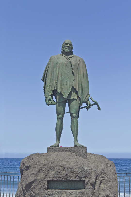
Mencey Bencomo
But general Alonso Fernández de Lugo kept his promise and came back and several more battles were fought, as was the battle of Agüere that came to cost Mencey Bencomo and his brother Tinguaro their lives.
Bencomo was the penultimate Mencey of Taoro, the most powerful of the kingdoms of Tenerife.
He led the first battle of Acentejo together with his brother Tinguaro, a successful war and a long celebrated victory but in the battle of Agüere they both were deadly wounded and in attempt to escape the aggressors they climbed the heights of San Roque, where they both perished.
Bencomo’s son and successor, Bentor was only Mencey for a short period of time and the tragic story that ensued illustrates the fate the conquest entailed for the Guanche people.
Foreseeing his defeat to the Spaniards, after the second battle of Acentejo, in the Orotava valley in 1496, he leaped to his death from the edge of a ravine, Tigaiga ravine, where a statue is risen in his honour.
Bentor, the last Mencey of Taoro, puts an abrupt end to the thousand years long, peaceful and fair reign of the Guanches.
His sorrowful ending mirrors the destiny of his people.
The entailment of the conquest
The Canary Islands have an amazing and exciting history that must be told, explained and remembered.
Their native people, Guanches, suffered all kinds of tremendous repressions, including genocide, by the Spanish colonisers who wanted to submit these people to the Spanish culture and religion as well as to profit economically by selling them as slaves.
It started off as isolated incidents when the aggressors captured native Guanches and took them along as private slaves or sporadically sold some of them.
But they soon discovered that it was a remarkably profitable business and it quickly developed into a large-scale commerce.
The Portuguese also realised this and were eager to follow in their footsteps and ventured to Africa for slave raids. The west Africans they captured were sold in Europe in the mid 1400s.
The lucrative slave trade stopped briefly when the Pope Engine IV, issued a Papal bull *see end article, in which he strictly forbade the capture and enslavement of the Guanches, anyone that defied the bull would be punished by excommunication.
But little did it help to stop the flourishing industry, the slave trade and colonisation was born and nothing could stop this profitable prospect. The Guanches suffered a horrific fate, genocide and slavery.
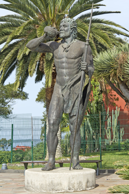
The legendary chief Tinguaro
Conclusion
The brave Guanches put up a tough and admirable fight against the conquest, but the archipelago eventually fell under the power of the Castilian crown.
As many survivors were relegated to slavery and shipped off to the mainland, the remaining few had but three options; to submit to the conquerors, to go into hiding in the mountains or to escape across the Ocean that once brought them here, yet again in search for a brighter future.
Freedom means you are unobstructed in living your life as you chose. Anything less is a form of slavery ~Wayne Dyer.
*Sicut durum: is the first Papal bull promulgated by Pope Eugene IV in Florence on January 13/ 1435. As it had little success another bull was promulgated later on.
Regimini gregis: was the new Papal bull in a second try to stop the wild slave trade.
The names of the islands in Canarian Berber:
Tenerife-Achinech, or Achinet.
La Gomera- Gomera.
La Palma-Benahoare.
El Hierro- Heró or Eseró.
Gran Canaria- Tamaran.
Lanzarote- Titerogakaet.
Fuerteventura- Maxorata or Erbania.
The nine Menceyatos/kingdoms in Tenerife in the time just before the conquest; Icod, Güímar, Taoro, Tegueste, Anaga, Tacoronte, Abona, Daute and Adeje.
Further readings;
The Poet Antonio de Viana (1578- 1650) turned the story of Dácil into one of his best-known poems in the Canary Islands, in his book: La conquista de Tenerife (1604).
The conquest of Tenerife (1604).
Sources;
Book: Conquista y colonización 1988
José Juan Acosta, Félix Rodríguez Lorenzo, Carmelo L. Quintero Padrón.
Book: The Amazigh migration to the Canary Islands.
And a long personal experience of the Islands.
#the canaries#history#writers on tumblr#writblr#writers#original content#travel#spain#canary islands#gran canaria#fuerteventura#tenerife#lanzarote#la gomera#la palma#el hierro
0 notes
Text
Seven beautiful wildflowers rising from the bottom of the ocean

Gran Canaria
The Canary Islands have as many names as they are diverse, the entire archipiélago is an astonishing patchwork of extreme wild landscapes and micro-climates.
Apart from that they have a generous supply of small paradises, surprises and adventures alike.
The group of seven islands, seven wildflowers, off the coast of North-West Africa are blessed with a warm subtropical climate, all year long, an eternal spring!
It is difficult to find words to describe their beauty, each one is a volcanic jewel, a priceless treasure.
The islands are just the top of a gigantic subaquatic mountain chain, rising a phenomenal 7.500 metres from the bottom of the Atlantic Ocean, as a result of ferocious volcanic eruptions.
The Canaries have a particularly interesting history, dramatic geography and is a veritable goldmine of fascinating and surprising small sites.
The islands are themselves a revelation, unique and dissimilar from anything else in the world.
In addition to being distinct from anything you have ever seen they are also different from each other.
The Canary Islands are located 100 kilometres (62 miles) from the African coast, and an astonishing 1.056 kilometres (1.700 miles) from the Spanish mainland, even though they belong to Spain.
The archipiélago consists of seven larger inhabited islands or thirteen including the smaller uninhabited ones.
As each island is unique, and differs greatly from the others, a deeper description is needed to familiarise oneself with each island, representing each one by a special Canarian wildflower, so we can discover the flora a bit more too. The islands are ordered from oldest to youngest.
Fuerteventura
The island of the golden beaches
Fuerteventura beach and Hypericum Canariensis
Fuerteventura is the oldest of all the islands in the archipelago, and is at its ripe age a paradise of beaches.
The island lacks some of the enormous mountains and high peaks that characterises many of its sisters but instead its topography is perfect for a myriad of water activities, such as : snorkelling, windsurfing, kite surfing, yachting, sport fishing and waterskiing.
The beautiful sandy island of Fuerteventura has a rugged beauty, exceptional beaches and a dramatic coastline, it is the second island in size after its bigger neighbour Tenerife.
The entire island has been declared a biosphere reserve, thanks to the diversity of its flora and fauna, its many microclimates are evident all around the island.
Its name is subject to wide discussions, Fuerteventura in Spanish means “strong winds” a reference to the windy conditions around the island that sometimes endanger nautical adventurers.
However, it might also refer to wealth, luck or destiny, a third theory suggests that the name derives from Latin “Fortunatae Insulalae” (fortunate islands).
In ancient times it was called Maxorata which means “children of the country” in ancient Canarian Berber, by the native inhabitants, the Guanches.
Lanzarote
The Island with the moon landscape
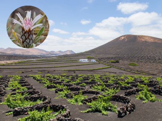
Grape trees in Lanzarote and Attaraylis Preauxiana
The distinct arid island of Lanzarote offers a volcanic moonscape, best compared with the actual landscape of the moon.
Nevertheless, it also has its invisible secrets, El golfo cráter is a volcanic crater on the shore of the peculiar island.
Inland, just a few metres from the coast, is a pool of water that has developed a green hue. The green comes from an algae living in the salt water in the pool.
The waters in the pool are still connected to the ocean via underground fissures, which keeps the water at sea level, and ensures that the pool doesn’t evaporate away.
Cooking food over a volcano.
On Lanzarote where the last volcanic eruption took place in 1824 there is still a significant amount of heat just below the surface.
In the National Park of Timanfaya you can visit a restaurant * , with a nine metres hole, dug to access the heat, and is used to grill.
The temperature of the grill reaches 400 degrees C and uses no energy.
Further, the island has some of the oddest vineyards in the world, as the island is volcanic, arid and has almost no soil or natural vegetation, to grow grape vines here takes quite a bit of effort.
Unlike most vineyards, where vines are planted in rows, on Lanzarote each vine is placed in a small depression with a semicircular wall of lava stone around it, to help protect it from the winds. The plants take root in the lava rock, where they get water from the moisture that condenses on the rocks.
Gran Canaria
The miniature continent

Roque nublo, Gran Canaria and Helianthemum inaguae, plant species considered in danger of extinction
Gran Canaria has a landscape forged by volcanoes.
The island rose from the bottom of the sea as a result of the force of volcanoes.
Then the volcanoes, the winds and the rain came together and sculpted the island of cliffs, fertile plains, deep ravines, black and golden fine sand beaches, natural pools, galleries, caves, stone arches, valleys and monoliths.
Such a geographical diversity of microclimates makes it possible for Gran Canaria to have so many different faces.
From its high altitudes, when looking down from the Pico de las Nieves (the snowy peak) and feeling the vertigo, as you stand at an altitude of almost two thousand metres the island looks very different from what it does when you see it from the coast, while hugging the ocean.
But it is the same island nonetheless: the heir of the volcano.
Today as the volcano has been sleeping for millennia and we can approach it without fear, we can see the island's volcanic heritage reflected in its nature.
Even higher up, where the island pierces the sky, lies the protected landscape of Las Cumbres de Gran Canaria (the summit), the high mountain region where a series of volcanoes that erupted three thousand years ago are aligned.
Inside the protected landscape of the sacred mountains of the island, declared a World Heritage site by UNESCO, we can observe the indigenous heritage the way natural caves or caves made by humans in the volcanic tuff were used as dwellings, barns, astronomy sites or sacred places for rituals.
These high peaks, covered in pine forests, marks the separation between the semi-deserted south and the lush, densely vegetated north.
When seeing the different climates, so paradoxical, like opposites, that is when you realise that this small island is truly home to several worlds, a continent in miniature.
Tenerife
Starry nights on Mount Teide

Mount Teide and Tajinaste rojo
Tenerife is the largest and most populated of the tropical archipelago, with a generous variety of landscapes: golden sand beaches, misty volcanoes, and a dense pine wood.
Mount Teide is not only the highest point in the entirety of Spain and the world’s third highest volcano, but with its peak measuring an astonishing 3.718 metres above sea level ( 7.500 metres from the ocean floor ), it also casts the longest shadow over the sea in the world. It is spectacular!
As that is not enough, Teide’s national park is the most visited park in all of Europe and it is, of course, home to Mount Teide, as well as a Natural World Heritage site.
Furthermore, Mount Teide literally separates the island in two different climate zones: the semi-deserted south and the rich, flourishing northern parts.
The waters in the southwest of the island are exceptionally rich in marine life and one of the few places in the world where you can actually see and interact with turtles and dolphins that live here all year long. This region is also visited by blue whales and orcas.
A true sanctuary for these incredible mammals that find ideal conditions for feeding and reproduction here.
The curious shadow of Mount Teide
The Canaries are due to their location, climatic conditions and mountain peaks blessed with the clearest and most unpolluted skies, excellent for stargazing, in the world.
In addition, Mount Teide has another secret: when the sun rises the Mount casts a curious pyramidal shadow over the Atlantic Ocean which disappears into the distance like a train truck.
The shadow changes as the day grows.
At dawn a silhouette is projected towards the island of La Gomera, while at dusk the shadow is pushed out towards Gran Canaria.
Views of the shadow are particularly good from the peak of Mount Teide itself. The silhouette on the ocean is in the shape of a perfect geometric triangle, which is astonishing especially as it is considered that the actual peak of Mount Teide does not have a pyramidal shape at all.
The shadow therefore seems to defy reason.
La Gomera
The forgotten island that was lost in time
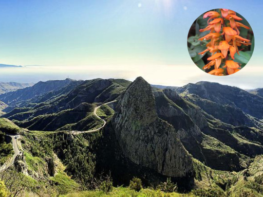
La Gomera and Digitalis (Isoplexis) canariensis
From a distance La Gomera appears as an impenetrable fortress, ringed with soaring rock walls. Noodle thin roads wiggle along cliff faces, and up ravines.
The white spots on this prehistoric landscape turns out to be houses impossibly placed on inaccessible escarpments.
Up close, however, the rough landscape turns out to be lush valleys, dense rainforests, glittering black pebble beaches and bold rock formations sculpted by volcanic activity and erosion.
Simply put, La Gomera’s shape is rather like an orange that has been cut in half then split into segments, which has left deep ravines or barrancos in between them.
By the coast beaches are set between the cliffs, this wild, mountainous landscape is filled with contrasts, it is a paradise for nature lovers.
Considering the inaccessible landscape it is not difficult to understand why the thousand years old whistle language still is especially deep rooted here.
They really needed it to communicate through rough mountainous terrain, and it has lived on since ancient times until now.
La Gomera’s prime attraction is the magical often misty National park “Garajonay”.
Clever though by gorges and filled with laurel rainforest, this prehistoric forest is responsible for the labyrinth of vegetation in the park, a park that is bewitching like a fairytale.
Here you will find more than a thousand species that, thanks to their isolation, include a large proportion impossible to find elsewhere.
Lush and dense laurel rainforests once grew across most of Southern Europe and North Africa but now they are only found here in the Canaries and the rest of Micronesia.
An interesting note, La Gomera is the only island that still uses its ancient native “Guanche “ name.
The legend of Gara and Jonah
The Canarian Romeo and Juliet
The Canaries is famously known as the land of legends and volcanoes, this special legend comes from La Gomera.
Long, long time ago, in the time of the Guanches, the first native of the archipiélago, a beautiful princess lived in La Gomera, her name was Gara.
This island was famous for its water springs that still exist (los chorros de Epina), which could predict if someone would find true love: if the waters remained quiet, without movement, it meant The person would find true love but if the waters got turbulent, the answer was negative.
During the Guanches New Year's feast, princess Gara and her friends visited the spring, as Gara approached, the still water started to become so turbulent that it was shaking, then a sun appeared in the waters and told her: What will happen will happen, run away from the fire Gara, or it will consume you.
The same day, Jonay, a handsome young Guanche and son of the king of Tenerife, visited the island with his father and other noblemen as they were invited to the new year’s feast in La Gomera.
When their eyes met, it was love at first sight!
They immediately announced to their parents that they wanted to get engaged.
It was then that the ocean got filled with fire, the big, powerful volcano Teide on Tenerife had erupted, and such was his fury that you could see it even from La Gomera.
That was when they remembered Jonay was from Tenerife, the island of fire and Gara was the princess of the holy springs.
Fire and water don’t mix! Their love was impossible.
It was first when their parents forbade the engagement that the volcano calmed down.
Back in Tenerife, Jonay couldn’t forget Gara and in the middle of the night he threw himself in the ocean and swam across to the island of La Gomera and Gara, where he and Gara ran together up the mountains, to the very highest top but as they discovered they were followed they took a stick and sharpened its two extremes.
Holding it in between themselves to their chests, they hugged, the sharpened stick pierced their hearts and they died together.
Since then the mountain is called Garajonay, in memory of the two lovers that preferred death rather than continue living separated.
This same place is nowadays a National park: "Garajonay”.
La Palma
The beauty (La bonita)
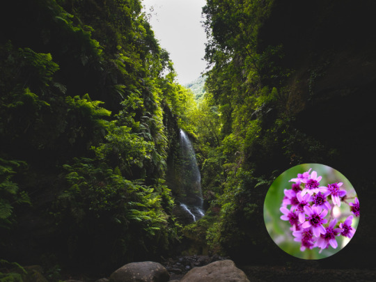
La palma and Pericallis hadrosoma
There are places that will give you unique, magical moments, moments when you think: this is what I always wanted to experience, places made just for you.
La Palma is one of those places.
From the top of the mountains you get a spectacular view, and if that is not enough you might even, if you are lucky, get to see a sea of clouds.
The heat from the sand almost burns your feet but the cool waters from the Atlantic quickly repairs the damage.
The pleasure is complete with the calming, soft and fresh scent of canary pines, from the abundant pine woods, that fill your senses and relax your body.
The beautiful, green La Palma is like a big, natural spa!
A natural spa that regenerates, revitalises you, and fills you with energy and good vibes.
It is mainly in December and January that snow appears on the highest points of the island, surrounded by pine trees.
With the top of the island covered by a white snow blanket, you wonder: is this really a subtropical island?
It is even possible to enjoy a snowball fight in the morning and finish the day with a warm, relaxing sunset swim in the Atlantic, life can not get much better than that!
El Hierro
The island with soul
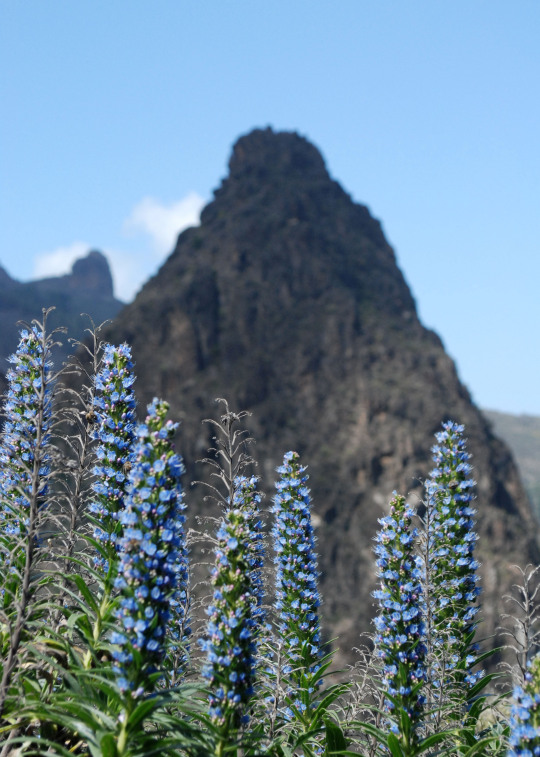
Tajinaste Azul
It is the youngest and it is tiny but overfilled with incredible natural wonders.
El Hierro is indeed the smallest of the fortunate (inhabited) islands, but it is an island with soul.
The island is more remarkable for what it doesn’t have than for what it has.
There is very little traffic here, the island has no hotel complexes, no buildings higher than two floors, no lifts and only one set of traffic lights.
Furthermore, it is almost completely self sufficient.
Since a while back El Hierro has been working towards making the entire island self-sufficient and they have almost reached their goal, other islands are following their example but are somewhat behind.
Beaches here are rare, to swim you either have to jump from the cliffs or enjoy the many natural pools, as a substitute for beaches, but the island's wonderful landscapes make up for the lack of beaches.
Ancient civilizations were just as impressed and fascinated by this array of exotic islands as we are today.
The archipielago forms a part of the Macronesian eco region and it is further referred to as “the islands of eternal spring” , the reason for that is that they are regulated by the Gulf Stream and trade winds, which contribute to their subtropical climate.
With little difference between seasons, they truly have an eternal spring!
Loved by countless civilizations, each one giving them a nickname, the islands have got as many names as there are stars in the sky, we find many names for those we love!

Tenerife
Canary Islands- the Romans.
The fortunate islands-the Numidians
The islands of eternal spring - the Greeks.
The everlasting islands- the Arabs.
The blessed islands-the phoenicians.
The islands of the fortunate-
The islands of the Guanches-the Guanches.
The islands of hope-
The Macronesian islands
The canary birds were named after these islands and not the other way around.
Caught in between volcanoes, legends and reality, they are marvellous islands on the limit of the world.
The sweet charm surrounding them and their positive energy works as a magnet!
You visit once and you are stuck, you fall in love and nothing else is comparable.
Their diversity is staggering, no other place in the world offers so many treasures compressed in such a small place.
It is truly an archipelago of a thousand experiences!
*El Diablo restaurant in Timanfaya.
#history#writers on tumblr#writblr#writers#original content#travel#spain#the canaries#canary islands#canarias#gran canaria#tenerife#fuerteventura#lanzarote#la palma#la gomera#el hierro#flowers
29 notes
·
View notes
Text
The most powerful fleet the world has ever seen with total sovereignty of the seas
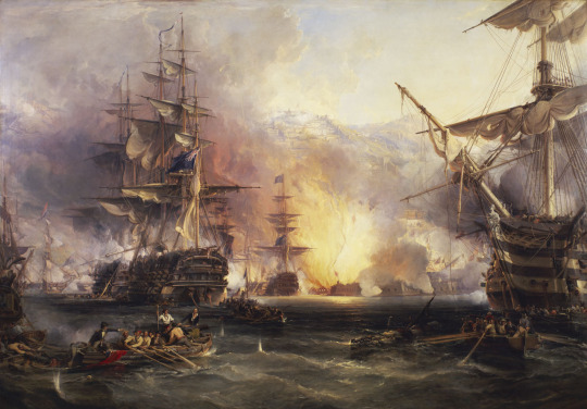
Bombardment of Algiers
This huge country, the largest in Africa, has a secret few people know of, embedded in its history. But this mystery is about to be revealed.
The forestal resources
Even though this enormous nation consists mostly of desert (80%), Algeria is much more than meets the eye! The Sahara is made up mostly of plateaus and sand dunes, and it is predominantly found in the southern parts.
The north west is composed of mountain elevations, meanwhile the north east also has massive mountains, plains and basins. It differs from the western parts in the sense that its basic topographic features do not equal the coastline.
Its long ridges, steep cliffs and huge mountains create an almost impenetrable refuge that has played an utmost important role throughout the country’s history, ever since Roman times.
Desert of Algeria, in the southern parts of the country.
It is the northern mountainous regions that are responsible for rainfalls that in turn causes seasonal rivers rising in the mountains bringing alluvial soil rich in minerals, thus extremely fertile, especially to the Tell the country’s heartland, an area made up of hills and fertile plains surrounding the narrow coastline.
It is here that we find most of the Algerian forest reserves. In ancient times a dense forest grew on these plains, inundated with wild beasts and reptiles, a perfect site for ship construction, because of the abundance of wood and proximity to the sea. Here is where the Algerian fleet was born!
This great nation can be described as a mosaic, where every historical event represents a small piece in the gigantic mosaic picture, and it is first when the pieces are joined together you understand the whole picture.
Wonder wood of Algeria
Algeria’s history of mosaic
Algeria has a colourful national history even though during the periods of the great Empires their influences dominated the history of the entire region, but during the times in between these great powers Algeria’s own history got a chance to prosper.
The Phoenician’s, an ancient civilization originating in the Levant region, located in modern day Lebanon, arrived on the North African coast around 900 BC where they established Carthage, in present day Tunisia around 800 BC. During this “classical” period the Algerian tribes lived on agriculture, manufacturing and trade.
Trade links between them and Carthage were intense and strong, something that made Algeria prosper both economically and technologically.
Carthage soon became a significant shipyard, the Algerians' close relationship with them resulted in mutual cooperation and eventually Algeria also developed a refined naval construction base from which it would later launch a naval power.
The similar geographical conditions and shared knowledge showed to be beneficial for both nations.
The dense forested areas, identical in both countries, consisted principally of pine and cedar wood trees, something that proved to be extremely useful in naval construction.
In that time every single ship was especially constructed to sail in a specific sea or maritime location. The sea in which the ship was supposed to sail decided the kind of wood, method and model that would be needed for its production.
Ships sailing in the Mediterranean area or the so-called “Mediterranean ships” were generally built with cedar wood or pine whilst linen was used in making ropes. These ships were painted with tar or bitumen.
An Algerian ship off a Barbary port
With the fall of the Carthaginian Empire and the arrival of the Romans new methods and advancements were adopted and further improved upon.
Even though the relation between the Algerians and the Romans were described as “stormy” , they brought reform and new knowledge in ship construction as well as improvements in the urbanisation of the country.
Later in the dawn of the Arabs and Islam 670-711 A.D., during the Umayyad dynasty, a diverse and further reformed method of ship construction was developed, something that further improved and refined the already existing highly developed naval construction techniques.
There is no doubt that this long chain of different influences from various countries and Empires and their different experiences, knowledge and techniques made up a solid base for ship construction. This basic knowledge was later improved, refined and perfected upon for an extended period of time , until a perfectly sophisticated and advanced Algerian ship making was developed, so refined that Algeria became the leading naval construction nation in the world.
Mission impossible
But it was not only the Algerians that possessed a large fleet, the Caliphate of the Ottomans had an impressive and well organised fleet as well.
This Islamic naval force was of utmost importance to the entire Caliphate yet it was still to expand considerably both in size and knowledge wise.The Caliphate asked for the cooperation from the powerful Algerian fleet early on, for mutual benefit throughout much of the fleet’s existence, an agreement forming an alliance, companionship and for mutual support.
Furthermore it was of essential importance to have experienced and well educated admirals and leaders in charge of the fleet, thankfully they existed in abundance. One of these great admirals was a man whose story we will learn about now.
The story begins with that Barbarossa or Admiral “Arrouj”, as was his real name, a European Muslim Navy Admiral whose roots go back to Albania, was assumed to a meeting with Sultan Selim I , and the Great Navy Commander of the Ottoman fleet, due to messages of desperate appeals sent from people in al Andalus (Spain during Moorish rule) to save their friends and family from the dark basements of torture where they were held prisoners.
The Sultan assigned Arrouj to a mission that today would be called “mission impossible” and gave him the strategic guidance to the mission.

Arrouj Barbarossa
To sum up the mission Admiral Arrouj was to sail from the far east of the Mediterranean in today’s Turkey to the far west in Andalusia, through all existing threats, then to anchor safely in one of the Andalusian cities, now under Christian rule, destroy the naval Spanish protectorate of that city through a surprise attack.
The surprise attack was an important strategy in order to discover the location of the torture basements. Having discovered the secret locations, they had to free the prisoners, Mozarabs (Spanish converts), Jews and others from the basements, after sunset.
The reason for the specific timing was to avoid the prisoners getting blinded by the sunlight, as a result of being captivated during years in darkness.
Finally they had to sail: by night, not to Turkey but to Algeria, taking an alternative route, in order to transport the prisoners in the fastest time possible on one hand, and to simultaneously lure the navy of the enemy on the other hand. End of mission!
The mission was more than impossible, however, the big surprise was that the Navy Commander carried out the mission with outstanding success!
What is even more surprising is that his brother repeated the same mission numerous times, together they saved tens of thousands of original Spanish Muslim converts, Jews and even Protestant Christians ( mostly English sailors taken hostages by piracy or in sea battles) from torture and death.

Ghosrof Barbarossa
The reputation of the brothers Arrouj and Ghosrof spread throughout the seas of the world, and the streets of the Catholic Europe scattered stories started to spread of the heroism of an Ottoman sailor, who sails like a horrific ghost that no one can stop.
The deliberated prisoners called him Baba Arrouj or Baba Arrouts (father Arrouts) out of their utmost respect and gratitude to him, who saved them from the horrors of the inquisition, this in turn led to the Italians distortion of his name to Barbarossa, Italian for red beard.
The great naval commander Arrouj defended the coasts of Algeria for a long time but was caught by the Spaniards, and brought to Spain where he was executed, and as “this” was not enough they cut off his head and paraded it throughout the city.
A sea fight with the Berber fleet
His brother Ghosrof, nicknamed “Khairiddine”, (meaning “the good” of the religion) from the ever gratefully prisoners he saved from al Andalus.
Khairiddine took his brother’s place and continued to fight for what was right. He sailed to Tunisia where the Spaniards and Portuguese were trying to invade the country, he destroyed their ships and liberated Tunisia and Algeria.
The Catholic world was now infuriated and gathered a coalition fleet, named “the Holy League” consisting of many different nations*, altogether 600 ships and 60.000 soldiers led by Europe's greatest naval commander at the time, Andrea Doria, facing the joined Caliphate’s and Algerian fleet under the commander Admiral Khairiddine Barbarossa and his 122 ships and 22.000 soldiers.
*The coalition fleet, the Holy League, consisted of the Papal state, Habsburg, Spain,Republic of Genoa, Republic of Venice and the knights of Malta.
They met in the battle of “Preveza” on the 28th of September 1538 AD. One of the greatest naval battles in history. Despite the fact that the coalition fleet outnumbered the Muslims in men, ammunition and ships,
Khairiddine Barbarossa, commander of the Ottoman Caliphate won the battle. It was a total victory, the European fleet was completely destroyed, and Andrea Doria ran away from the battle site, the battle that didn’t last more than five hours.
After this great victory, a state of fear and panic spread throughout the enemies' princedoms and the combined Algerian and Ottomans Islamic Navy became the master of the Mediterranean Sea for three centuries to come, without rival.
The family Piri Reis

Piri’s Map of central and south America.
After the victory of Khairiddine Barbarossa, the Naval fleets of the gigantic Ottoman Empire became the greatest naval power of the seas and oceans.
The two brothers Barbarossa were students and taught all the secrets of the sea by a man called Kemal Piri Reís, al reís is Arabic for head, meaning head of the ship or captain.
Al Reís is Arabic for head, as in head of the ship or captain.
He was also a teacher to his own nephew: Ahmed Mohedeen Piri, and gave him an excellent education.
Kemal Piri Reís, joined the brothers Barbarossa on many of their journeys including the once to al Andalus to free the prisoners, he was well experienced and a great support for the brothers in their missions.
Kemal Reís’s nephew was more interested in drawing maps than anything else, he later became one of the best and most famous cartographers in the world. He always stayed close to his uncle and joined him on most of his missions.
Together they all rescued the prisoners in al Andalus, stood by and assisted the Mamluks in Egypt in their struggle against Portuguese colonisation as well as many other missions, and battles as in 1499 during the battle of Zonkuyl where Kemal Reís used cannons aboard his ship for the very first time in history, surprising his enemies, and winning the battle.
Eleven years later in 1510 a storm broke out at sea and the ship that carried Kemal Reís capsized and sank, resulting in the then 60 years old Captain Kemal losing his life, after a lifetime long of service to the caliphate’s fleet and people in need.
Nevertheless, after his uncle's death Ahmed Mohedeen Piri Reís continued sailing with the ships at sea.He drew the first ever map of the American continent. This map shows, and is the ultimate proof that the Americas were both discovered and mapped, long before Christofer Columbus discovered the so-called new world.
However, Piri Reís was not the first one either to discover these lands, the Africans, Arabs and Andalusians had been travelling for quite a while to both south and North America by then. But Piri Reís maps are, unlike other historical accounts that can be denied, not only solid proof that he was there before Columbus but he had also drawn detailed maps of the entire continent.
The maps were an accurate and very detailed picture of what he saw and experienced, he also wrote a book in where he explained his travels *. He later drew a map of the Antarctic, also this one in detail.
*Piri Reis book with detailed descriptions of what he saw: Kitabi Bahrisi (1521-1525).
In 1929 historians found a map on a piece of gazelle skin, and traced the map back to a 16 th century Turkish Admiral named: Piri Reis.
But contrary to other maps, from that time period, this one showed the exact coast of Antarctica as it exists today under the ice-cover, an amazing accomplishment because it meant that it was drawn in a time when Antarctica was ice-free. The map also accurately shows the coast of Europe and Africa but as already said it is the coast of Antarctica that stands out, as this region remained undiscovered for at least 300 years.
Moreover, when cartographers superimposed Piri Reis’s map over a modern day map they were astonished to discover that it was fantastically accurate in the most minute of details. It also included flora and fauna, everything where it belonged.
It was not only the oldest map showing the two Americas, the South Pole, Europe, Africa and Asia but it was so surprisingly accurate, that even the distances between the continents were remarkably precise.
Summary

Constantine, Algeria.
The longest lived and most powerful fleet in the world is the 300 years old prominent Algerian maritime fleet. At the time the greatest powers in the world were represented by the Ottoman Caliphate followed by England and France then the rising stars: Spain and Portugal, built on the ruins of al Andalus.
It was the events preceding the expansion of the Algerian fleet that also became the reason for its absolute sovereignty, and these historical events took place in Spain. It all began with the inquisition, When the Muslims and Jews were exiled from al Andalus (Spain) they brought the news with them of the poor conditions inside the country and the horrific torture that went on inside the basements.
The news spread as fire all over the Mediterranean, this in turn resulted in an urgent response for rescuing the prisoners, which brought the joint Ottoman Caliphate and the Algerian fleets to extremes.
As an answer to this rescue missions the pope gave his blessings to Spain and Portugal to establish a crusade, to Christianize North Africa and more important move the battles within Spain into Muslim territories, from defence in Spain to offence in North Africa. The Spaniards and the Pope Paul III, formed a coalition fleet together with several other countries, as earlier mentioned * see end article.
In the battle of Preveza the Algerian fleet totally defeated the opponents, this radical defeat was maybe the real turning point, it gave the Algerian fleet indisputable power, total respect and put fear into their enemies for a long, long time to come.
This is what made the fleet invincible and gave them total sovereignty in the world. Now they had to put order in the Mediterranean that had long been a breeding ground for European piracy. Random attacks on North African coasts and ships, fierce, unpredictable pirate attacks in between the Europeans themselves and others as well, caused lawlessness in the whole region and threatened to destabilise the trade in the entire Mediterranean.
The Algerian fleet stepped up and started to repel the European aggression, protecting trade and battling pirate operations.
New arrangements were imposed, the Algerian fleet in agreement with the Ottoman Empire, requested travelling ships in the area to pay a fee, a monetary payment to the Algerian fleet, in turn the fleet would guarantee the ships safety and be fully responsible for its protection as long as it remained in Mediterranean territory.
The Algerian fleet was responsible for all ships in the Mediterranean area (and other territories later on) anyone engaging in piracy was dealt with, hard handedly, any ship that didn’t pay their fee or disrespected the rules was not allowed to sail in the region.
In the beginning incidents and confrontations occurred but with time everything changed, everyone started to follow the rules. The powerful Algerian fleet succeeded in obtaining cosmos from chaos and bringing safety and security in the region, their protection was rarely needed anymore, they had completely rooted out European piracy!
But the most powerful naval fleet in history, in terms of length of time as well as power and control, their 300 years of golden rule and glory saw its end with the battle of Navarino 1827.
After many great and honourable deeds, the fleet retired, but Algeria remains a country with a flourishing mosaic and deep, honourable history roots, a history worthy of being written in gold!
Algerian Landscape
Interesting facts:
Algeria was the first country in the world to officially recognise the French Revolution.
Algeria helped France by lending them money and providing food during times of great famines. In the beginning of the 18th century France had an enormous debt to Algeria. The French being ungrateful, hungry for revenge due to the Algerians serving as a powerful naval base as well as helping the Caliphate in their naval struggles and lending their support to the Ottoman Empire, the French wanted revenge and added to that, being unable to repay the Algerians they went on to colonise the nation.
Algeria was attacked and conquered by the French the same year its fleet was dissolved 1827, the conquest was followed by plunder and mass killings, to the extent that Algeria is known in the Arab world as “the country of a million martyrs”.
One of the first countries in the world to recognise the United States as independent, was also Algeria.
It was believed, in Europe, until 1507 that those lands visited by Columbus were part of Asia and not a new continent.
The map of Piri Reis was depicted on the reverse of the Turkish 10 million lira (1999-2005) and on the new 10 lira banknote of (2005-2009).
#history#writers on tumblr#writblr#writers#original content#travel#algeria#north africa#berbers#berber#tunisia#fleet#algerian fleet#naval fleet#naval history#barbarossa#pirates#pirate ship#pirates of carrabean#map#map making
11 notes
·
View notes
Text
The Pharos; Giving hope and light for a thousand years
-One of the ancient worlds seven wonders-
A recreation of the lighthouse of Alexandria
The little Egyptian city of Rhacotis, or Rhakotis in Greek(modern-day Alexandria), already existed in 1900 B.C with its perfect location by the Mediterranean, protected from huge waves and raging sea by the isle of Pharos as well as a pearl band of smaller islands serving as a natural breakwater, giving the harbour safe anchorage conditions. Adding to its advantages, it was fed with sweet waters both from lake Maryut and the Nile river. The city of Rhacotis had long served as a coastal shipping facility and haven supplying the isle of Pharos with goods.
According to Homer, the famous Hellenic writer, the port by the isle of Pharos existed in antiquity. He even described this island in his classic literary work, Odysseus, where Menelaus was stranded on the island of Pharos on his return from the Trojan war.
The old harbour still exists today, but unfortunately at the bottom of the sea on the north side of today’s Ras El-Tin. The city was a centre of civilization, it controlled the commerce between Egypt and the rest of the Mediterranean. Its position was perfect as a vital crossing point for merchants on their maritime routes between Asia and Europe. Egypt was a major producer of grain in the ancient and medieval world likewise cotton was almost as significant.
An unexpected delay and preparation for the future
Alexander the great
There is no doubt that the riches associated with the trade, the potential and strategic position of the location and the diversity of ideas and cultures were in the back of Alexander the Great’s mind when in 332 B.C. he attacked the Egyptian coast, just outside of modern-day Alexandria. He arrived there after having conquered the island of Tyre (Known in Latin as Tyrus) but the conquest was unexpectedly delayed.
But to his surprise, the siege was so prolonged, the procedure so difficult, and the resistance so fierce he and his army had to come up with a new strategy. Alexander was in a hurry to conquer the world, but his plans were put on hold for seven whole months as the siege of the island of Tyre lasted from January to August 332 B.C.
As Alexander could not attack the island from the sea, he built a kilometre-long causeway, stretching out to the island on a natural land bridge, no more than two meters deep. After a long preparation and a fierce fight he eventually won the battle and out of anger he burned down the entire island. The similarities between the island of Tyre and the isle of Pharos are striking.
Leaving devastation behind he proceeded to gain control over Egypt. After Alexander’s conquest of Egypt, big plans started to be made for the little city of Rhacotis. The city wasn’t called Rhacotis to begin with, it had another ancient Egyptian name but came to be called Rhacotis by the Greeks.
*Racotis in Greek means; "construction in progress" or "building site".
During the planning and preparation for the expansion and improvements of the already existing city and its harbour, the historical accounts tell us about a peculiar incident.
When Dinocrates, Alexander’s architect, traced the layout of the new city, he didn’t have any chalk at hand so he used barley flour instead. No sooner had he finished than a huge flock of birds appeared, darkening the sky and devouring the flour. At first, Alexander thought it was a bad omen, but his seers convinced him that it was a sign that his new city would provide sustenance for the whole known world.
To assume their position as new rulers of Egypt, Alexander and his men needed a city worthy of their status, a spectacular, contemporary and continental city, a city directed to the sea and such a city needed a spacious and safe harbour. Renewing the already existing port by improving the safety and security of its ships wasn’t enough.
Alexander needed a lighthouse but not any lighthouse would do, he wanted a multipurpose structure, one that could assure safety in the port, and enable the new rulers to have proper surveillance of the city, its harbour, and the country as a whole, in the same time as gaining a building to impress the world!
A safe haven
Satellite view of the port.
The idea of constructing a double harbour was motivated by the fact that there are two principal winds and offshore wave directions. Furthermore, the existence of two separate harbours was advantageous as moving ships from one harbour to another would protect the ships from wave disturbances and keep them safe.
Adding to that there were ships arriving from the Nile as well as others coming from the Mediterranean Sea, spearing them would also avoid confusion in the port.
As a connection between the two harbours, they constructed a so-called “Heptastadion” or mole. It was a giant causeway to link Pharos island to the main coast, giving it a name based on its length. Heptastadion is Greek for seven stadia — Hepta means seven, and a station being a Greek unit of length measuring approximately 180 metres. Altogether, it was more than three-quarters of a mile long.
Ships could now be transferred from the west port of Eunostos to the eastern harbour of Portus Magnus, without going to sea, but through canals cutting through the Heptastadion. On top of that bridges were constructed over the canals.
Now, after the construction was completed, the two harbours were connected by canals and separated by a T-shaped peninsula. Yet, after the constructions were completed they still had a lot to do. The port was deep, making it suitable for ships with big drafts, and the haven was well protected from dangerous northern winds by a string of islands.
Still, without a compass or navigational instruments, it was challenging to find one’s bearings by just observing the coastline as the area around the Nile was an endless landscape of marshes and deserts, the land was so low that it sometimes seemed to be hiding behind the sea. Many sailors found that just when they thought the worst part of their journey was over, their ships would become stranded on a stretch of sand.
A final hurdle was the dabble line of reefs in front of Alexandria, which could prove fatal to sailors and incoming ships. If the winds weren’t favourable, some of these reefs were on the surface while others were submerged, thus presenting even more danger for navigation. Clearly, a lighthouse was necessary, especially after the expansion. But not any lighthouse would do.
The Pharos
The tower of Hercules, a miniature version of the Alexandria lighthouse in La Coruña, Spain.
With the construction of the new harbour completed, the attention of Alexander’s men shifted to building the lighthouse. It was anticipated to be a colossal structure, solid, sturdy and able to withstand the tests of time as well as the raging of the sea.
During the construction of the massive monument, the cooperation of experienced and competent Egyptian engineers must have contributed greatly. The construction, ordered by Ptolemy I (one of Alexander’s generals and the first ruler of Greek origin in Egypt) began in 290 B.C. and likely took about twenty years.
Ptolemy I.
Ancient historical accounts are confusing and contradicting when it comes to describing the lighthouse, but if we were to believe Strabo, a Greek geographer, and Pliny the Elder, a Roman historian, they describe it as—
“Covered with magnificent white marble (or as others say white limestone), and was composed of three basic structures: a rectangular base, an octangular midsection and a cylindrical upper section where two beacons were located”.
Inside the structure, there was a sloping shaft built to lift up fuel needed for the fire at the top. A mirror reflected the sunlight during the day while a fire was used at night. Furthermore, there was a system of 72 ramps with the capability of fitting two horses, one going and one coming, simultaneously, thus the ramp system gave access to the entire lighthouse and all its stories.
For people on foot, there was a whole series of spiral stairs throughout the lighthouse and all its levels, where people could access the entirety of the lighthouse.
The interior itself was massive, it is believed that 364 rooms were built in the Pharos measuring from ten to twenty cubit squares.
*Cubit is an ancient measure of length. It was based on the rough distance between the elbow and the middle finger.
The rooms were designed with vents and windows, in order to absorb gusts of wind against the lighthouse, reducing the risk of collapse. Another function of these rooms was as storage for fuel for the beacon. The rooms were covered by beams of teakwood and decorated with arches of stones.
The viewing galleries were situated on the second and third floors, where visitors could enjoy the beautiful scenery and experience a view from around 400 feet, or 122 meters.
But it was not only the harbour and the sea view that was worth seeing from up there, the water supplying canal and its sewers, and the city’s wide spectacular avenues were a rarity in the eastern Mediterranean at the time. The wondrous city was divided into five districts, but nearly a quarter of its extension was occupied by palaces and royal gardens and their enclosures.
Important visitors had the privilege of being lavishly entertained in some of the rooms allocated for this purpose. The Pharos was fitted with every scientific improvement known at the time.
Finally, at the top of the Pharos, two mirrors were perched; they could reflect the light more than 35 miles (56 kilometres) offshore during daytime, thus making it possible to send mirror signals as a way of communicating with ships at sea. And by night it worked with a lit fire.
Conflicting theories exist on how the mirrors were made, some testimonies assure it was made from a highly polished metal whilst others insist it was made of silver-backed glass or transparent stone. Regardless of what the building material was, the lighthouse dominated the harbour for centuries and the impression it left on the visitor must have been immense.
Ibn Jubayr, a traveller writes —
“Descriptions of it fall short, the eyes fail to comprehend it, and words are inadequate, so vast is the spectacle.”
The abundance of rooms, corridors and connecting spaces inside the Pharos never seemed to stop confusing visitors, it was like a maze, a labyrinth that hindered visitors from finding their way without a guide.
The historian Makrizi makes a stunning statement —
“Whoever entered this lighthouse became distracted and lost their way by reason of the number of chambers and stories and corridors which it contained, so when the Arabs arrived in Alexandria with an army, a body of them entered the Pharos on horseback but lost their way, till they came upon a crevice in the crab of glass*, upon which the structure was founded and many of them fell through it, and perished.”
*During the later pharaonic dynasties a special foundation was used in the shape of a ”glass crab”, it was supposed to support a higher buildings or monuments reinforcing their foundation, stabilizing them and distributing the heavy weight.
Finally, the lighthouse also served as a military lookout for approaching enemy ships or any other danger. It is no coincidence that endless legends and myths surround the great Pharos, which was more than only a pleasure for the eyes, as it served a practical purpose too.
Its shining light safely guided ships for centuries and placed the port city in the centre of Mediterranean trade for a very, very long time. It was one of the seven wonders of the ancient world!
The destruction of the Pharos
The Pharos of Alexandria
Nevertheless, the Pharos didn’t withstand the test of time. In spite of its sturdy construction, it was brutally damaged in the earthquakes of 956, 1303 and 1323 C.E. (A.D.).
By 1408, the Pharos was crippled and collapsed into the coastline. From its ruins still holding foundations, the Egyptian fort of Qaitbay was built on the same site, using the same stones left over from the Pharos.
Qaitbay fort.
Even though most opinions are unanimous that it was probably the last three earthquakes that caused the destruction of the lighthouse, one man has another theory.
The 10th-century writer Al-Mas’Ud is convinced the Byzantines sent an ancient spy to the Pharos, they convinced him there was a treasure at the bottom of the lighthouse, and while searching for the treasure, the spy sabotaged its foundation ultimately causing the lighthouse to collapse.
No matter the reason, it continued to prosper long after the Greeks, and even outlived many other rulers and civilizations, then finally, it gave in to forces stronger than itself and fell to ruins. The lighthouse had a major impact on Arab minaret architecture and strongly influenced the way they were built.
It is interesting to note that the Arabic word for minaret and lighthouse is the same: Al Minarah.
But the influence didn’t stop there many other languages lent the word for lighthouse from Pharos. ** see end article.
Even though the Pharos is a much-copied veritable wonder it was not always successful in its mission to safeguard ships, as marine archaeologists have discovered over 40 shipwrecks around the ancient harbour. But on the other hand, who can say how many more disasters there would have been without the lighthouse's safe guidance to port?
Losing a light larger than life
Underwater remains.
Guarding the coast, bathed in blistering sun, and washed by turbulent, salty waters, stood once one of the ancient world’s most impressive structures.
For centuries the Pharos was the sign of ingenuity, raising just a tiny bit short of the great pyramid as another of the seven wonders of the ancient world. Overlooking the Mediterranean’s most turbulent waters it stood for centuries as a saviour for seafarers. It shaped human history. It was the first such building to be constructed and the most famous one.
This indispensable monument of brilliance, the first of its kind in the world, has been a role model for all such buildings, to this day, and for centuries to come.
Rhacotis grew to become Alexandria and later developed further into the Mediterranean bride. But the lighthouse and wonder structure of Pharos that gave us hope and light for centuries, was lost to the sea, forever.
The lost remnants of the lighthouse of Alexandria, the penultimate of the seven wonders of the ancient world, lie underwater near the entrance to the eastern port.
The university of Alexandria using the logo of the Pharo of Alexandria.
**Here are some examples of languages that lent the word Pharos, to showcase the importance of the Pharos. (note that some languages replaced the Greek ph for f).
French: Phare
Greek: Φάρος
Italian: Faro
Norwegian: Fyr (The same word is used in Slavic languages, Bulgarian, Serbian and Russian)
Portuguese: Farol
Romanian: Far
Spanish: Faro
Swedish: Fyr
Turkish: Fener, Feneri
Meanwhile Arabic has its own word
Al-Minarah. Which both means lighthouse and minaret the word derives from the Arabic word Nour: Light
#ancient greece#ancient greek#ancient history#ancient#ancient egypt#history#alexander the great#ptolemy#macedonia#alexandria#egypt#egyptology#qaitbay#fort#lighthouse#lighthouse of alexandria#pharos#writers on tumblr#writblr#writers#original content#travel
14 notes
·
View notes
Text
The Pyrenees- The mountain chain that got its name from a tragic love story
The Pyrenees
The Pyrenees is a massive, icy and inaccessible mountain chain spread across an almost 500 kilometres long belt, from the Mediterranean to the Atlantic ocean in the northernmost borders of Spain in between freezing rivers, steep mountainsides and valleys whose heart beats in a totally different manner compared to other places. It beats in a rhythm that elsewhere disappeared long ago. Its peaks look to Europe from above with fulfilment, dignity, and pride, pride in its greatness and its past.
During centuries, the Pyrenees were capturing and enclosing the Iberian peninsula, isolating it from the outside world. But everything depends on how you perceive and experience it, it also works as a door with access to the rest of the continent and the entire world. Nevertheless, the mountain chain still possesses a mystical aura.
The romantic bell towers rise over small villages, scattered all over the cordilleran belt from one end to the other. Like mermaids waiting to attract the traveller, their songs are distant and difficult to hear, but thanks to them, old traditions still survive, traditions from a real distant past when the Pyrenees were ruled by gods, nymphs, monsters, and magical beings.
The mountain became its own world, everything started and ended here and the myths explained a reality that we, until today, have failed to understand.
The creation according to geology
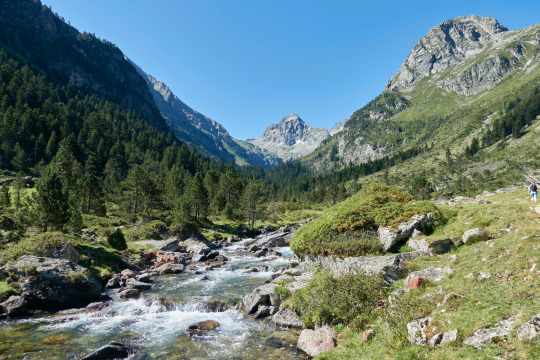
The Pyrenees
As a natural wall of separation, the Pyrenees part the Iberian peninsula from the rest of Europe. This region can be divided into three sections, the western, the central and the oriental part. More than 100 million years ago the Iberian tectonic plate separated from the European, letting the Atlantic Ocean fill up the empty space that appeared between France and Spain.
Later on, the direction of the movements of the two plates reversed and the two landmasses kept approaching each other instead until they collided.
The result of this collision is the formation of the impressive cordillera called the Pyrenees. This geological phase is called: Orogenesis alpina, as simultaneously other tectonic plates also collided, creating other geological phenomena like the Alps. Generally speaking, the Pyrenees have two historical periods, one earlier and one later.
Summing up the events: The Pyrenees were created due to the Iberian peninsula collision with Central Europe.
The creation according to mythology
The Pyrenees derives from Greek and means: New Fire (Pyros: fire, Neos: new). According to the most famous and widespread creation legend of how the Pyrenees came to be, Gerión, a deformed three-headed creature gained control of the Kingdom of Tubal (Spain). He wanted the beautiful Princess Pyrene but she was in love with Hércules, the Greek and Hellenic semi-god.
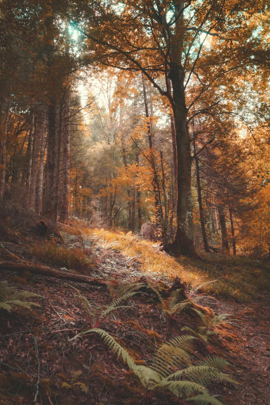
The Pyrenees Forest
Knowing that the monster would come for her in anger, she ran away into the woods, in the highlands, to hide from the three-headed creature. Gerión in turn, who was in love with the princess but was rejected and aware that he would have to kill Pyrene to gain total control as the new king of Hispania, followed her to the Pyrenees, the country’s borders.
When he couldn’t find her he decided to burn down the whole vast area even though he knew the princess would die in the flames. The fire spread in one of the most beautiful mountainous regions in Spain, destroying everything in its wake. Animals, vegetation and entire villages were wiped from the face of the earth.
Princess Pyrene screamed for help surrounded by flames, knowing that soon the fire would end her life. Hércules, who had seen the flames and heard her screams, ran to assist her.
He ran deeper and deeper inside the burning forest but in vain, it was too late, the princess was dead and the flames that claimed her life also destroyed the entire region, turning it into burning charcoal. Hércules, the great warrior and half gold, who fought the Iberian enemies, couldn’t save his beloved, beautiful princess Pyrene.
Devastated he started to cover her body with ashes, as if that was not enough, he continued with stones, more and more of them, and then boulders. He continued like that for a long time, unintentionally creating a mountain chain, while screaming “Pyrene, Pyreneeee”, this is how according to the legends the Pyrenees came to be and also where they got their name.
Pyrene and Hércules’s love created this mountain chain, and you can clearly see the exact spot where Pyrene rests, as she is buried just under the highest peak of the whole cordillera, known as Aneto.
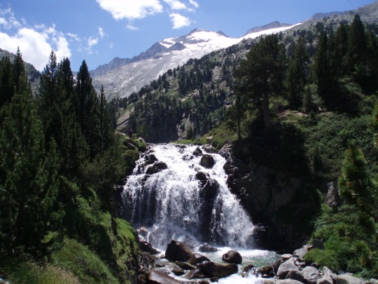
The Pyrenees waterfall
The Aneto is the highest peak in the Pyrenees; it reaches 3.000 metres. Yet another legend tells a different story: after the death of a nymph, the snow engulfed the Valley as it melted the water started to run in springs and rivers, plants and trees grew everywhere. This is when people started to come to live in the Pyrenees.
One of them was Netú, who with the help of an arrow killed “Atlan”, a predecessor to the ancient Atlanteans who carried the earth on his shoulders. God, seeing the injustice, decided to punish Netú and hit him with lightning. Netú exploded in the valley buried under thousands of rocks, creating the highest top “the Aneto”.
The lonely flower
The remote and isolated location of the Pyrenees and its hostile environment made it a perfect hideout for Spanish fugitives in the times of dictatorship as well as a sanctuary for refugees in the Second World War, escaping either Franco’s troops or the Germans.
Since prehistoric times the inhabitants of these mountains have seen how their valleys became the routes for Cartagineses, Romans, Arabs and French troops through Spain, on their way to or from battles.
The steep mountainsides, watchful peaks, secret caves, beautiful waterfalls, and deep forests make the Pyrenees and its surroundings the perfect environment for fantastic creatures and dark tales. In this beautiful but hostile environment grows one of the most captivating flowers in the world, the snow flower called Edelweiss.
The story goes like this: One night a star complained to the moon that it was jealous of the earth, its people, and the animals, who lived there. Hearing the complaint the Great Spirit got infuriated and decided to change the little star’s destiny, letting it have what it wanted.
He turned her into a flower while keeping her star shape. Planted on the top of the Pyrenees. Soon the little flower realised her mistake, although beautiful she was tied to the earth and her only companions were rocks and ice.

Edelweiss
The mountains of Spain
Spain is a country of great contrasts, it has deserts, deep forests and inaccessible mountains. This is a country of variety, opposites and paradoxes, a land with a thousand faces.
Spain is one of the most mountainous countries in Europe yet amongst all those mountain systems, volcanoes and peaks, there is none that reaches amazing altitudes!
The Pyrenees, the northernmost mountain belt in Spain, can be regarded either as a wall, hindrance or as a door of opportunities, a refuge of peace, a place to be closer to heaven.
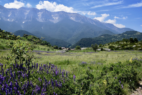
The Pyrenees
Spain’s highest mountains;
Mount Teide — 3.715 m. Tenerife, Canary Islands.
Mulhacén — 3.478 m. Sierra Nevada, Granada.
Aneto — 3.404 m. Pyrenees, Huesca.
Veleta — 3.394 m. Sierra Nevada, Granada.
Pico Posets — 3.369 m. Pyrenees.
Monte Perdido — 3.355 m.
Vignemale — 3.298 m.
Geological information:
Néstor Martin (1887- 1938) Las Palmas de Gran Canaria.
#pyrenees#spain#history#aneto#hercules#pyrene#ancient greek#greek mythology#greek mitology#myths#mythical beings#iberian#edelweiss#forest#mountains#river#writers on tumblr#writblr#writers#original content#travel#legends
1 note
·
View note
Text
The Unforgettable Trip to the World Of Glass

Lake at night.
We were going to visit the glass workshops in the region of Småland, the poorest region in Sweden, also known to the locals as the “kingdom of glass”. I was honestly not very enthusiastic, the thought of a dark workshop with a hot oven wasn’t attractive and the whole idea sounded rather boring to me, but for the sake of participating, I decided to go along.
We arrived in the province of Småland by night and the lights from the illuminated cottages, reflected in the black waters of the lake, made the whole lake look like a night sky filled with sparkling stars. The next morning we woke up in the deep wilderness, the dense forests, the glassy mirror-like lakes, the effervescent rivers and the wild animals had already given me inspiration.
I philosophically thought: this was probably the perfect spot for starting the glass production, the area was surrounded by forests and the wood would have been perfect for fuel for the ovens. Besides the wild animals would have served as inspiration and as models.
Typical Swedish bird by Målerås glassworks.
Starting the actual tour around the glassworks, I was again pleasantly surprised, this time by watching the glass blowers creating artworks by blowing through a pipe.
The whole process looked rather easy but once you try it yourself, you realise how much experience and practice you need. It is very challenging doing your own glass bowl and vase, and most of the time it looks like nothing!
It is here, in the dim-lit glass workshop, where the glass blowers take out a piece of the orange “glowing” liquid from their oven, this liquid glass attached to a pipe becomes radiant orange in the dark workshop as the only light present is the glimmer of the oven, then when they blow into the pipe, the magic starts.
Glassmaking, similar to that we saw.
Slowly, as if the orange liquid had a will of its own, shapes start forming in the front of our eyes, it grows and retracts, like it had its own plans.
While the orange clot keeps changing its appearance, your imagination runs wild:
What will it be?
What is it going to look like in the end?
Meanwhile, the orange clot continues to change its shape until at last, as if it finally made up its mind, it settles for the ultimate shape. It is then that you realise, what the orange dot knew all along, that is a flower vase, a drinking glass or a horse.

A decorative glass bowl like the ones we saw.
You realise you could stay here forever, watching the glass blowers blowing their creations without getting bored without even feeling the time passing by, it is magical!
Deep inside these forests of wilderness is where Swedish glass production and its success story began.
During hundreds of years, these handy glassblowers transformed sand, sodium carbonate and limestone into sparkling glass with the help of the heat of their ovens.
Glass candle holder by Orrefors glassworks.
But to imagine that these cheap ingredients would make up the composition of the beautiful shimmery glass and that it would reach such fame wasn’t something the two war veterans, who started the business, would have dreamt possible in 1742 when they started Kosta glass production.
From the beginning, there were hundreds of glassblowing workshops in the region but today only 12 remain.
If you would fit up with glassmaking, something very unlikely, you can also visit one of the three last virgin forests in Europe, they too are impressive and as if there are not enough animals inside the woods, there are also wildlife parks like “Kålmorden” filled with wild creatures.
Wolf by Målerås glassworks.
If you prefer to glide along the treetops and experience your own wild adventure you will find Europe’s longest zip line just around the corner.
Another sweeter activity is to visit “Margareta’s dockskåp” (Margaret’s dollhouse) in Kosta. It is filled with a world of fairytales, everything from teddy bears and dolls to charming dollhouses.
You can even send your own broken and sick teddy bear to the doctor, who will sew him together and cure him.
Before, glassmaking produced glass for Swedish households throughout the country, but with the fierce competition from glass mass production from low-wage countries, this was no longer possible. Instead, the Swedish glass production has turned its business into art, something we are thankful for that makes it possible for us to still enjoy it. Its competitors have become other artists competing with their designs.
The province of Småland is a fantastic world of glass, they have created magic since 1742, their unique art of glass is world-famous and their designs are exceptional and sophisticated.
I never regretted my trip through the world of glass, instead, I got surprisingly impressed at how beautiful the shining, diamond-like, sparkling glass really was! It was a memorable trip I will never forget but will carry with me forever!
Mickejohans, a Swedish glassmaker who uses completely new techniques for glassmaking.
Some of the glass workshops we visited include;
Kosta glassworks.
Målerås glassworks.
Orrefors glassworks.
Skrufs glassworks.
Mickejohans glass creations.
Bergdala glassworks.
The three virgin forests in Småland are; Tylöskog, Kålmorden and Tiveden.
You can find more information on glassworks in Småland here.
#traveling#europe travel#travel#european#europe#scandinavia#sweden#glass#glasswork#glass art#art#artwork#history#writblr#writers on tumblr#writers#original content#småland#glassmaking#glass animals#vase#glass blowing#glassblowers
2 notes
·
View notes
Text
The Lost Atlantis: the missing link between continents.
Stormy waves
If there is a corner in the world, where mythology and history meet, where mysteries become reality, a place where destiny crosses paths with adventure, a place of true stories of ancient times and a faraway past whose ruins were preserved throughout time, where the cruellest of chronics teaches us a moral, something like a reminder. Where would that be?
Legendary geographical places are communal in popular mythologies, but maybe they would be more striking if their size was really impressive, if their destiny was tragic enough or if the entire continent simply were to disappear, from one day to another, sunken, buried under the sea, never to be heard or seen again.
If such a place existed, it would undoubtedly be the splendid and glorious maritime Empire of Atlantis. The continent that gave its name to the ocean, the Atlantic, which so suddenly and brutally swallowed it, without warning, without remorse and in silence.
In spite of great scientific progress in our era, we humans are still ignorant about many things that are yet to be discovered.
The beginning
Atlantis was a big island, an Empire, in the middle of the Atlantic Ocean outside of the “pillars of Hercules”; the name given to the island, in the middle of the Gibraltar strait, by the Greeks.
According to Hellenic mythology, one of their gods, Hércules, separated the Iberian peninsula and its mountain chains from the mountains of Atlas in Morocco, to join together the two oceans: the Mediterranean and the Atlantic.
This is how the island of the pillars of Hercules was created. This island later disappeared, buried under the ocean together with Atlantis, thus sharing its fate.
Atlantis was, without a doubt, a powerful, continental, maritime Empire with total supremacy over all the seas and oceans, it was identifiable by its circular rings; a complicated system of canals that served multiple purposes.
Their technological advancements in the fields of energy, mechanics and genetics, reached unimaginable, unprecedented heights.
Is it possible Atlantis was the cradle of civilization on earth?
The description of Atlantis
The splendid capital of Atlantis was called “The City of Atlantis” or as the Greeks called it, “Poseidopolis”. It was a city of incomparable beauty.
Its buildings were constructed in black and red stones decorated with precious metals, there were even walls of pure gold. The statues were carved in white Marmor from the mountains and black subterranean stones, covered in silver and gold.
And all of this was protected by a complex system of canals rigorously guarded by security keepers and lock-gates.
The inland regions of the island were connected to the sea through an enormous navigatable canal. It is reasonable to deduce that the power in Atlantis was centred around winning the sovereignty of the seas.
To arrive at the coast of Atlantis, surrounded by ocean, and with the only route to or from the Empire through water, couldn’t have been an easy task for the poor sailors at the time. They had to have felt inferior.
The citizens of Atlantis could count on a powerful army and a vast fleet capable of facing and dominating the ancient states of the Mediterranean's military forces.
How channels would have looked like in Atlantis
On the central island was where the principal buildings, governmental edifice and structures belonging to the state of Atlantis were found. On the same island but on higher grounds you would find the acropolis, the royal palace and the temples dedicated to Poseidon.
The entire island and everything on it were protected by various hillocks of earth, these were a kind of rows or lines made of earth and connected to solid ground by five tunnels.
These tunnels could accommodate ships or boats that sailed through the canals, every single route was thoroughly secured by towers, lock gates and sluice gates.
The external ring was connected through a 500 meters long canal directly to the ocean. The ships sailed through the entire network of canals.
The magnificent irrigation canal was of utmost importance for the drainage of the water that was collected in the central plain between the two hills. The wall that surrounded the circles was constructed with red and black stones and decorated with precious metals.
In Atlantis they extracted copper, silver and precious metals and the ships coming into the harbours brought ceramic plates, spices and rare minerals from faraway Empires.
Technical progress and general development
According to the chronics and historical accounts, the inhabitants of Atlantis were outstanding, intelligent and bright. In addition to being intelligent, they were beautiful and very ambitious.
They were physically much stronger than the modern human being, and their body size was impressive.
The achievements of the Atlantean civilization were extraordinary and the level of progress was extremely high in all areas of life.
Some investigators say Atlanteans could create ultra-fast vehicles, in which they flew through the air and under the sea. Their deep knowledge of physics, mathematics and mechanics made it possible to create equipment of maximum quality and with unusual properties. And it was these devices that helped them relocate easily and quickly through the air.
Nevertheless, the progress and technical development improved gradually and reached unprecedented levels. As their flying vehicles needed energy, they had developed powerful crystal pyramids that served a dual purpose.
On one hand, it produced energy by concentrating and multiplying the sun energy, not only for their devices but much beyond that.
Moreover, these pyramids could not only produce energy, but they also distributed it to where it was needed. Crystal was not only used in the production of their “energy” pyramids but also widely used for other purposes like experimental and aesthetic ones. They even dominated laser techniques and genetic copying.
Atlantis was famously known for its abundance of a special species of elephants
Economically the country was prosperous, a person was paid properly for his work and there were no poor people or beggars.
So, the country’s social situation was stable and Atlantis was renowned, especially in the oriental parts of the Mediterranean where it left a strong impression on the citizens of these nations.
Consequently, it was not hard to understand why various chronics and historical accounts still exist until today, about those rich highly developed strangers.
This admiration later turned to bitterness as a result of multiple wars and occupations from the Atlantean side, as they came to invade a large part of Africa until Egypt as well as dominating western parts of Europe as far as Italy.
Their most powerful enemies were the effective and competent armies and fleets of the Greek and Egyptian Empires.
But excessive knowledge always creates temptation no matter how morally pure the Atlanteans were from the beginning, at the end, the negative tendencies started to grow within the society, until they became a danger to the continent, as a whole.
The abuse of power from a small elite group brought further tragedy leading to long term wars and it was partially this, as it distracted the country, that became one of the reasons that one day the whole continent would suddenly be swallowed by the ocean. Personal interests, the hunger for riches and power are friends of ruin and destruction, gradually getting richer, capturing the conscience of the masses.
When the perversion reached its climax and Atlantis became a hell of cruelty, the catastrophe shook the continent.
The Atlanteans were repeatedly warned about the catastrophe but as the disaster was delayed, they relaxed and returned to sin.
Until one day, they found themselves in the middle of a war with the Greeks in the confusion of the prolonged war and when they were just about to lose the battle, disaster struck!
The whole Atlantis was dragged by the lethal waves into the ocean and disappeared.
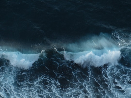
Stormy waves
The final destruction
The great destruction of Atlantis started with the appearance of enormous cracks, into which the rivers plunged. Death continued in the entire state, the mountains were shattered and fell into the valleys, and the rivers plunged into the ocean.
Such downpour fell, that it was as if heaven gates had opened at once. The terrible roar of the thunder didn’t cease, it didn’t last for long but it must have felt like an eternity. Then, everything became silent.
When this continent sank its secrets vanished with it.
Ever since, uncountable search waves set out, looking for the lost continent. Generation after generation explored the seas and ocean in search of the forfeited oasis, but without success.
Since then, more than 25.000 books have been written about Atlantis and innumerable theories about its whereabouts.
Traces
References to Atlantis are found on both seashores of the Atlantic Ocean in the form of chronics, historical accounts and cave paintings, as well as paintings in mortuary temples in Egypt.
Striking similarities exist between paintings found in Gran Canaria, the Mayas in México and the ones found in the Caribbean. Simultaneously, surprising resemblances exist among the legends and historical accounts as well, in the ones of the Mayas, Incas and Caribbean.
The Mayas talk about a giant landmass, far back in the past, that suddenly sank, it was said to be located: “where the sun is born, and where there is nothing but water”.
The Aztecs called it “Aztland”, and the Nahuas denominated it “Nahoatlan” (the earth between waters).
Even as far away as India, texts allude to a “large and very powerful country” and placed it in a zone that is identical to the Atlantic Ocean, they continued to describe it as “7 expansive islands which capital was the ‘Village of the three mountains’” and assured it was immersed into the ocean by indescribable force.
On the oriental side of the Atlantic Ocean, the Atlantean's former archenemies also talk about the event, on one side the Greek and Plato disciple of Socrates and a Hellenic philosopher.
In his “dialogue of Timeo and Critias” where he refers to the sources received from the Egyptians to legislator Salón, the description Plato left behind of Atlantis was very extensive and detailed.
In reference to the disaster itself he says: “A series of massive earth trembles, flooding and inundations submerged the entire continent, in just one day and one night of terror”.
The Egyptians in turn, are in the possession of historical documents, in the form of papyrus rolls and inscriptions in temples and funerary chambers, telling the stories of the wars they fought with the Atlantic Empire and their tragic end.
Nevertheless, after Atlantis vanished all communications between the different continents which were made possible because of the Atlantean's frequent travels and easy movements, also ended abruptly, as abruptly as the existence of Atlantis itself.
Ship at sea
As Atlantis which acted as a “bridge” of communication between continents unexpectedly succumbed to the forces of the ocean and ceased to exist, so did the exchange of ideas, knowledge and information everything unexpectedly stopped, the only thing remaining was the stories and accounts about them Atlantis was the broken link between Europe, America and Africa.
The enigma of its location
The Atlantic Ocean is considered the youngest of the oceans, it has also been the scenario of extraordinary geologic activity.
Oceanographic expeditions, in the 19th and 20th centuries, have established with certainty the presence of a gigantic mountainous system expanding through the centre of the Atlantic Ocean, from one polar circle to the other, having only one interruption in the middle.
Thus, there are two separated subaquatic mountain chains, the northern Atlantic chain and the southern Atlantic chain.
The northern Atlantic system consists of two parallel mountainous lineups, separated by a narrow but deep ditch. It is this ditch that is the centre of indications of evidence that testify to the existence of Atlantis.
A part of this mountain chain was a subaquatic mount, called Atlantis, where 60 years ago a piece of petrified lava was found. This piece of lava was proven to not be solidifiable except in contact with the air.
Years later it became clear that this same piece of lava couldn’t even have come from subaquatic volcanoes, on the same mountain animal fossils were discovered, belonging to animal species that only could have existed on land.
Furthermore, a large amount of strange-looking calcareous discs were found, in proximity to the other discoveries, which were proven to be of man-made origin.
The findings were tested by the so-called carbon 14 method, and it was proven that thousands of years ago these discs would have been on dry land in the open air.
Consequently, the subaquatic mount Atlantis was once, in ancient times, an island.
During the last decades, oceanographic expeditions have found materials proving that the end of the European and North American ice age was provoked by the sinking of a mountainous chain, precisely the disappearance of Atlantis.
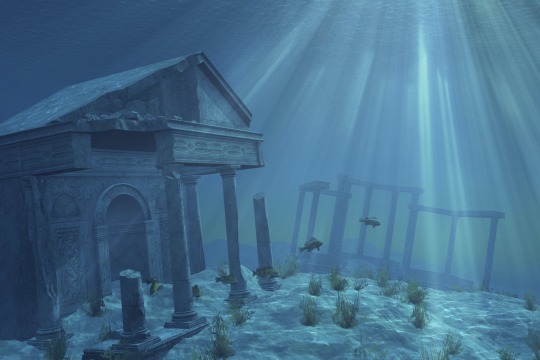
Atlantis
Geological consequences
Anyhow, the sinking of Atlantis was only the last step in a series of natural disasters that, for thousands of years, gradually sank the entire continent of Atlantis, completely.
According to a theory of events of the Canary Islands, when Atlantis disappeared in the sea it left behind some of its highest mountain tops, the ones that today make up the Canary Islands, Cabo Verde, Madeira and the Azores.
Concerning the Canary Islands, we know scientifically, since time and the latest developments have proven it even stronger, that these islands have their volcanic activity to thank for its existence.
The volcanic activity is generated by the movements and collisions of sheets, in the earth’s crust deep down at the bottom of the Atlantic Ocean.
During different geological eras, eruptions and immersions of these islands have been taking place, they were even part of the African mainland at one point and time in history.
The scientific possibilities and the imaginative ideas always existed that these islands could somehow be connected to Atlantis.
Since the disappearance of Atlantis, the Canary Islands have always been connected to the myth and geological hypothesis in western history and culture.*see In between volcanic fire and salty oceans.
The submergence of Atlantis had, as a direct result, multiple consequences.
First, the opening of the Gibraltar channel, which up until then, had been a huge lake called lake Mediterranean. But as pressure build-up due to subaquatic volcanic activity in the Atlantic Ocean in proximity to the North African coast, both inside the Mediterranean and in the Atlantic, the land finally gave in to the rising pressure and the Iberian peninsula and its mountain chains were blown apart from the Atlas Mountains in northern Morocco, creating Gibraltar channel caused by the explosion and mixing the two waters together.
Until then, the waters in the Mediterranean derived from rivers, lakes, natural springs and interconnected water systems, mainly from Northern Africa.
As a result of the enormous catastrophic event, these freshwater resources were pushed beneath the North African plateaus and earth where they were hidden as subterranean reserves for thousands of years, and were just recently discovered.*see Deserts in disguise.
Another result of the disaster was the disappearance of the island Gadeira or the “pillars of Hercules” and the dissipation of three Greek islands of Santorini in the Mediterranean. In spite of the fact that the Canary Islands seem like a plausible location, there are many theories suggesting other locations.
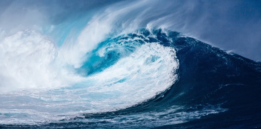
Wave
The reason for all these multiple theories is that the subaquatic geology is limitedly explored and in addition to that the oceans are incredibly vast.
There is an infinite number of islands, landmasses, and parts of continents immersed, since the beginning of time, but only very few have been discovered. Of the few continents that were found, the most famous are Lemuria; in between the Pacific and Indian Ocean, Zealand; hidden under New Zealand, surrounded by the Pacific Ocean, Doggerland; outside the coastline of modern days France, Belgium, Denmark, Germany, Netherlands, Norway, Ireland and UK, Kerguelen; French overseas territory in proximity to Antártica in the Southern Indian Ocean.
These islands are also denominated “The desolated islands”.
Critics question the existence of Atlantis in the same way they were sceptical of the existence of Troy and deemed it a “legend” until the Archeologist Schliemann proved that the Iliad of Homerus actually described true scenarios and an actual place.
Conclusion
We know that nothing in the universe is static; everything turns, everything moves, everything changes places, nothing is constant. There is much science can’t explain and even more that is unknown to us, yet to be discovered.
Atlantis was completely erased from history but it has survived in our hearts until this day.
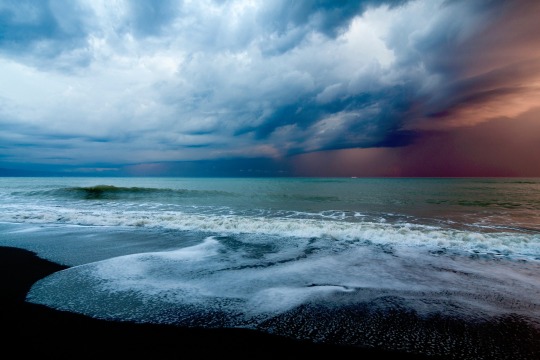
Sea
The lesson we can learn from Atlantis is that, if the legends and myths are true and the destruction happened as a result of man’s arrogance, we should reconsider our own behaviours, we are contaminating the earth, creating major catastrophes on the planet.
In the same way, the Atlanteans did and Plato warned that their arrogance was the cause of their destruction. If Atlantis was simply a product of imagination or a reality reflected in ancient writings, miraculously preserved until today, remains a mystery.
Maybe our own civilization will be faced with a similar destiny and we will not be to our predecessors, but a myth like Atlantis is to us. And one day, in the future, they will be looking for us in vain at the bottom of the oceans.
Jelly fish
#atlantis#atlantic city#atlantic ocean#history#legends#mythical city#mythical#myths#geology#geography#the canaries#mayans#inca#plato#ancient greek#greek mitology#ancient history#ancient egypt#writers on tumblr#writblr#writers#original content#ancient era#lost city#lost civilization
1 note
·
View note
Text
The Snowmen and Their Ketchup Bottles
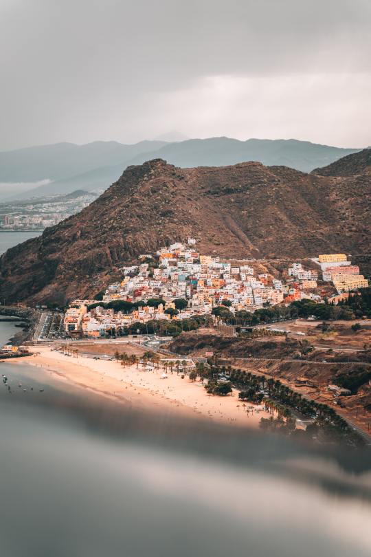
The Canary Islands.
My family’s many travels through Europe resulted in that, one day we suddenly decided, enough is enough and we undertook the enormous decision to move from the extreme north of Europe to the extreme south and even a little further over part of the Atlantic Ocean to the Canary Islands.
I considered this to be a permanent vacation. Even though we were experienced travelers, the cultural differences were tremendous.
Scandinavians are known for being introverted and reserved a reputation we reconfirmed during one of our numerous journeys through France, where we came across a short, delicate French lady. Oblivious to the fact that we understood her, she referred to us mentioning a well-known French expression to describe the Scandinavians: “They are like ketchup bottles for a long time, nothing comes, then suddenly all come at once!”.

A ketchup bottle, or better said, Scandinavians in the eyes of the French.
Traveling across the European continent made us aware of some existing stereotypes about us, some of which were sadly true.
Once we arrived in the Canarian paradise, I started to attend school. It was a small, cozy Scandinavian school where everyone knew everyone, just beside our little school there was a large local Canarian school. At least twice a year our two schools participated in multiple events like sports competitions, different projects, singing, and other means of collaboration. During these events cultural clashes were inevitable.
I would stay somewhere in between the two groups and observe the interactions with utmost interest.
First, the headteachers or supervisors would welcome us, foreigners, to their school and proceed to ask the Canarian students, who wanted to hold a speech and further welcome us, strangers. Immediately, five thousand hands reached for the sky but the decision as to whom was to be chosen was somewhat delayed as a result the excited Canarians started to jump and put up a second hand.
Further delays resulted in the passionate students proceeded to become vocal. “Me, me, me!”
When the responsible party finally decided who would have the honor to talk, the enthusiasm and noise were so overwhelming that no one could hear anything, and the decision had to be repeated over and over again.
Then the turn came to us foreigners to officially thank them for the invitation and further courtesies, the question was then asked, who wanted to speak? Then, the noisy school building all of a sudden became completely silent, no one spoke. No hands reached for the sky, no enthusiasm, instead, the Nordic students hid one behind the other, trying to disappear.
What the Canarians saw as a “chance to shine” or an opportunity to make themselves heard and seen was for the Scandinavians perceived as scary, uncomfortable, and stressful.
After the first meeting between the two schools, the curious Canarian children watched, from one side of the enormous and generously decorated entrance hall, the invited foreigners who were standing on the opposite side. They had a hard time containing themselves from walking straight up and initiating the contact, but judging from the circumstances and the not-so-warm reaction from the Scandinavians they put in an even bigger effort to postpone the contact.
Ten minutes into the staring contest the local students had reached their limit. Yet again curiosity got the better of them, unable to stop themselves they approached the foreigners introducing themselves all at the same time. In their excitement, it was impossible to make out each and everyone’s names but they didn’t mind, they were satisfied to have started the conversation.
After the short introduction of the Scandinavians and with everyone properly introduced, the Canarians bombarded us with questions.
“That Santa Claus, of yours, where does he live and how far does he travel?”
They asked. The surprised Nordic children blubbered something along the lines of: “what do you mean, he doesn’t come here?”.
The confident and intellectual Canarians answered: “No, of course not, if he would come this far south he would melt, that’s why we have ‘the three wise men’ instead” (The three wise men are a catholic tradition and Santa Claus is a protestant replacement).
They continued: “the three wise men are used to traveling in warmer regions, giving gifts, at least in Spain”.
Subsequently, twice a year, these events were organized between the two different schools, and step by step we got to know each other a little more thus the closed-up, introverted Scandinavians opened up to the friendly, warm-hearted, and passionate Canarian students.
You could say that the northern snowmen slowly melted and adapted to the contrasting cultural habits as well as the distinct environment until they finally became almost as Canarian as the Canarians themselves.
Even though, I think many of those who adapted perfectly well to the new circumstances, still had deep, deep inside their melted hearts, a small tiny bottle of ketchup.
I have learned that people from different cultures react and experience things in drastically different ways, and when dealing with people from different backgrounds, you need to be able to adapt and view things from their perspective.
Nevertheless, learning about other cultures is a lifelong journey, an endless journey with lots to learn.
An image to illustrate the excitement levels of the Canarian children.
Originally Published on Medium
#memoir#writers on tumblr#writblr#writers#original content#spain#travel#canary islands#the canaries#original story#story#short story#storytelling#tumblr#tumblog#europe travel#traveling#wonderlust#scandinavia#north europe
1 note
·
View note
Text
A Handkerchief Collection Full of Emotions
I don’t know exactly when it started, but I think it was just before I started school (6 years old). I am not even sure how it started though I guess, it was probably a gift from Grandfather that triggered the whole “handkerchief collection business”.
Every time we went to the mall, I had to have a look at their supply.
I can still remember where it was located in the store, it was the 4th and 5th aisle to the left after entering. If Grandfather was with us I would most certainly get a set of three new handkerchiefs if he was not, the chances were slim to none. That much I had figured out!
Mom always answered: “you have handkerchiefs at home, or wait until your birthday when I asked her to buy me some.”
Grandfather was much simpler; he really understood the need for collecting handkerchiefs and the deep meaning behind them. Moreover, he knew how to deal with mom.
He was admirable and resourceful, his strategies always worked and she always gave in and let him buy me a set in the end.
I convinced Grandfather, he convinced mom, that’s called collaboration.
My handkerchiefs were strictly for collecting, decorating and organising purposes not everyday use.
To let you in on the secret; the strategy was simple, to gather as many different categories as possible. There were fairytale handkerchiefs with motifs like Snow White, little red riding hood, the three little pigs and the wolf, sleeping beauty etc.
But there were also seasonal handkerchiefs with spring motifs like eggs, rabbits, spring flowers, Christmas ones with a Christmas tree, snowmen or gingerbread shaped men.
Furthermore summer themes, autumn themes, handkerchiefs with balloons, dolls, balls, horses a never-ending world of possibilities.
The selection was enormous then there were the ones that were solid, one coloured in all imaginable and unimaginable colours, the brighter the better! You could never have too many!
Once at home, the handkerchiefs had to be brought together on my bed then grouped and sorted either by colour, theme or size or all three together. I assure you the possibilities were endless and that made the whole affair that much more fascinating.
When everything was ready and organised, it had to be reorganised again in a different way and so it went on and on. By now you are probably thinking, what a useless hobby! But for me, it was a way of learning about my own emotions.
Every single handkerchief made me feel a certain way and it was important getting to know myself. Every day I chose a different one, depending on my mood on that special day. The beauty of collecting handkerchiefs is that it never ends. You can go on collecting them perpetually, it creates a kind of assurance that they can keep you busy forever. That is reason enough to become a devoted handkerchief collector.
I was famous for my handkerchief obsession, everyone knew about it but they shared little to no interest in my stack.
Except for Grandfather who open-heartedly supported my arduous dedication of accumulating handkerchiefs and with complete sincerity and commitment participated in my folding, categorizing and organising sessions.
He realised early on the importance of such collections and he constantly kept himself updated with the latest handkerchief news.
When he saw me one of the first things he asked was: “how many do you have now?”
In the beginning, the answer was easy and straightforward: “6 or 8 then 10″.
Later on, they became too many for my little brain to count, then I simply said: “many!”
They served another purpose too, for beside my bed I had a little table that had to be wiped every day and decorated with a fresh handkerchief every single day, the handkerchief that best described how I felt that particular day.
My little sister Hannah was opposed to my passion for the world of handkerchiefs, she was hostile right from the beginning. Her problem was that she did not understand the need for such insignificant objects, why choose a set of handkerchiefs when you could ask for something much bigger like an enormous teddy bear or a big doll instead.
To her, it seemed so trivial. As she couldn’t comprehend the importance of such possessions it made her angry.
It was the day before Christmas and I was cleaning my little table and putting on a new handkerchief, this time I chose the one with the three gingerbread men, it was perfect!
As I turned my back to the table, just for a second, I heard a terrifying noise and when I looked I saw my sister with the newly bought handkerchief by her nose, she had just blown her nose in it! It was as if she wanted to tell me: “this is how you use a handkerchief, as if I didn’t already know.”
Hannah was jealous first because I had discovered a delightful hobby she couldn’t understand, and secondly because the handkerchiefs had absorbed all my attention, I had no time for her anymore.
It was the worst day of my life (until then), a total devastation.
I cried for days and during the rest of my childhood, I always compared disasters and tragedies with that handkerchief catastrophe/mishap.
Mom said: “I will wash it for you, it will be like new and you can iron it too, nothing helped.” To me, Hannah had insulted my inner feelings, after all the handkerchiefs represented my emotions.
Since then, I never liked that handkerchief anymore but gradually I got other interests, even though deep, deep inside I can still feel the anguish from that day. The whole handkerchief addiction helped me understand myself better and that came in handy later in life.
Girl with handkerchiefs
#memoir#story#writers on tumblr#writblr#my writing#writers#lifelessons#short story#stories#family#grandfather
2 notes
·
View notes